Barn Island – Stonington
- Barn Island Wildlife Management Area
- Palmer Neck Road, Stonington, CT
- Trailhead: 41°20’22.38″N, 71°52’38.91″W
- Last Time Hiked: November 30, 2014
- Approximate distance hiked: 5.0 miles
- Fairly easy with some slight elevation.
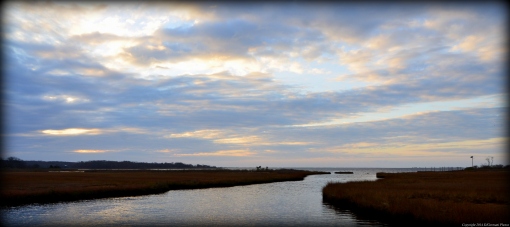
I met up with a fellow blogger this morning for a hike in her neck of the woods. She is quite familiar with the property and has been here several times. This would be my first venture onto this property. Hunting is allowed here but we were able to explore the property without the worry of hunters as hunting is not allowed on Sundays in Connecticut. We started the hike from the parking area by the informational sign and followed the stone dust path as it went downhill through a small section of woods before coming to the tidal flats. In this area there are great views of Little Narragansett Bay beyond the golden grass of the flats. In the distance you can see the Watch Hill Light and Napatree Point. Continuing along the path we headed back into another sections of woods. Here we came to another sign with a map of the property. We went right here leaving the woods and into another area of tidal flats. Here we saw an egret as well as some ducks. We soon turned right at the next intersection onto a grass road. This is actually a spur trail that leads to the eastern edge of the property. Along this stretch we saw a great blue heron and more ducks. The Latimer Reef Light (actually in New York) is visible from here on clear days. We soon found ourselves back in the woods and climbing slightly uphill. Along this stretch are several stone walls and a cemetery with graves dating back to the 1800’s. Soon the trail ends and comes to a paved road. The road, named Brucker Pentway, passes a few homes and the entrance of the Boy Scouts Camp Kitchtau. We turned left onto an unnamed road shortly after the stucco barn. This road led back to the wildlife management area. Passing the gate at the entrance of the property we found ourselves on another grass road. We were surrounded by fields that would be home to wildflowers in the summer months. In the fields were several poles with bluebird houses on them. This road would eventually lead back into the woods. Shortly after entering the woods we came to another intersection. We turned right here. The trail then winds through an area of woods for a while passing several stone walls. There are several narrow side trails along this stretch. It is best to stay on the main trail and go left at all “major” intersections until you return to the sign with the map where we made the first turn. When we reached the sign we turned right and retraced our steps back to the parking area. On the other side of the parking area there is a short spur trail that leads to a small sandy point into the bay. The short walk is worth it for the views.
Trail map can be found at: Barn Island.
