Catamint Brook Preserve – Cumberland
- Catamint Brook Preserve
- Tower Hill Road, Cumberland RI
- Trailhead: 41°59’39.75″N, 71°26’20.73″W
- Last Time Hiked: November 5, 2023
- Approximate distance hiked: 1.7 miles
- Moderate.
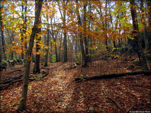
Newly opened to the public, Catamint Brook Preserve provides a nice moderate hike through the hills of Northern Cumberland passing remnants of yesteryear. The yellow blaze loop is 1.7 miles in length and starts at the small parking area on Tower Hill Road. For this hike, stay to the right and follow the trail slightly downhill. Almost immediately, you are at an intersection with green blazes. Take a right here to see the schoolhouse site. Nothing remains other than the perimeter stone wall. Returning to the yellow trail, it winds downhill steadily for a bit while traversing the eastern portion of the property. Along the way there is a cairn (pile of stones), likely a left over from the stone wall construction during the farming days. You will pass some red blazes (not currently on the map). With that being said, it is obvious there are plans for more trails on this property in the future. For now follow the yellow blazes. Soon you will come to a fairly impressive glacial boulder before coming to the “Farmers Dam”. This dam, built in the 1750s, crosses over Catamint Brook. The trail then climbs a bit and onto the Diamond Hill State Management Area before turning sharply to the left. The unmarked trail ahead leads into a web of unmarked trails. Be sure to wear orange for this hike as hunting is allowed on the Management Area. The trail soon leaves State property and back into the preserve. Stone walls and ledges flank the trail before crossing the brook once again. Just after the brook on the left (green blazed) is a short spur trail to the “Farmers Quarry”. There are some large cut stones here. It is also a good spot to sit for a moment. Continuing along the loop trail, you will pass some more ledges and wind out to Tower Hill Road. Here turn left and almost immediately left again back onto the trail. The trail soon crosses a driveway, narrows, then climbs up a hill with an outcrop at its peak. From here it winds through a grove of pitch pines before coming to a cart path. Turning right here will lead you back to the parking area. The acquisition of this property by the Cumberland Land Trust has made it possible for a trail greenway from the Middle School on Route 120 to Mercy Woods via Ash Swamp, unmarked trails on Town property north of Ash Swamp, Catamint Brook, Diamond Hill State Management Area, Diamond Hill Town Park, and the Warner Trail to Mercy Woods.
Between Stone Walls and Ledges
