Archive for May, 2020

Sycamore Landing – Lincoln


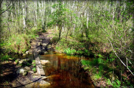
This small property wedged between the Blackstone River and the bike path is the home to The Blackstone River Watershed Council. Yesteryear it served as a dump for a nearby mill and later a scrap yard for automobiles. Over several years the volunteers have steadily cleaned up the site and made improvements to bring it back to a near natural state and to offer the land for passive recreation. A short network of trails have recently been blazed here as well. Though a short hike, it offers stunning and sweeping up close views of the Blackstone River. Starting from the parking area below the bike path parking lots walk toward the split rail fence. Just before the fence turn to the left and follow the path. You will soon see red blazes. The red blaze trail follows the shore of the river offering several spots to take in the great views. Along the way be on the look out for the massive and towering sycamore tree that gives this property its name. At the southern end of the property the red trail turns to the right and loops back to the north following a row of utility poles. Soon there will be a trail intersection. To the right is the blue blazed trail. Turn right here and follow this trail through the interior of the property. You will soon find yourself within a predominantly locust shaded meadow. The blue trail continues ahead to the left of the red building upon the hill. The trail then turns to the left into a grassy area behind the Watershed Council Building. After passing the building stay to the right to get to the parking area. Take your time here while visiting. You will see evidence of beaver activity or might catch a glimpse of deer or turkey. Geese and ducks were also observed here. For information about the Watershed Council and the Friends of The Blackstone click here!

TWRI-Syca02

The Blackstone River

Table Rock Trail – Hopkinton

  • Table Rock Trail
  • Stubtown Road, Hopkinton, RI
  • Trailhead:  41°30’1.04″N, 71°46’20.93″W
  • Last Time Hiked: May 25, 2020
  • Approximate distance hiked: 2.8 miles
  • Moderate, some elevation, rocky footing in areas.


The aptly named Table Rock Trail is the newest trail in the Canonchet Preserves of Hopkinton. This hike is done to complete a loop rather than an out and back hike. For this hike I’ve opted to eliminate the road walking first. With that being said, from the parking area at the dead end of Stubtown Road start walking down the road (easterly) from where you drove in. You will pass a few homes and the parking area for Ashville Pond. At nine tenths of a mile, just after utility pole 6 turn right onto the orange blazed trail. This is the Table Rock Trail. For the next 1.2 miles this trail winds up and down several hills, follows ridge lines, crosses brooks, weaves through an archaeological site, passes stone walls, and by an abundance of mountain laurel speckled with rhododendrons. You will come upon the table rock formation the trail is named for as well as an old foundation and boulders put here by the glaciers. At the end of the orange blazed trail turn right onto the yellow blazed Canonchet Trail. The remainder of the hike, uphill at that, follows the yellow blazes pass cairns, a massive boulder, and stone walls flanking the lane that was once the western end of Stubtown Road. The trail eventually comes to Stubtown Road where you have started the hike. When archery hunting is allowed here from October 1st through January 31st, be sure to wear orange.

TWRI-TRT07

The Table Rock

Mud Bottom Brook – West Greenwich

  • Mud Bottom Brook – Big River Management Area
  • New London Turnpike, West Greenwich, RI
  • Trailhead:  41°37’4.38″N, 71°35’46.70″W
  • Last Time Hiked: May 16, 2020
  • Approximate distance hiked: 4.5 miles
  • Moderate, navigation can be difficult.


First and foremost, I would advise not to attempt this hike without a map, GPS tracking, good sense of direction, or all of the above. I personally have ventured into Big River enough times to feel comfortable enough to wander its many, many, many trails. To say Big River has a vast network of trails is a gross understatement. For this hike I took a wrong turn along the way and found myself on a trail that was not on the Great Swamp Press map and found myself relying on GPS tracking and my internal compass to make my way back to a main trail. (My guest did a great job at remaining calm!!) With that being said, I am going to attempt to recall my route, but please don’t rely on this post alone if you attempt this hike. From the parking area at the end of New London Turnpike by the Wincheck Gun Club we passed the gate and followed the pine tree flanked dirt road for about four tenths of a mile. Turning left the trail then winds downhill to its end. Here we turned right onto a trail called Sweet Sawmill Road. This trail climbs slightly uphill passing some stone walls on the right. At the next intersection we turned left and followed that trail just under a half mile to its end. The trail widens at its end, stay to the right here. The trail then declines slightly into the valley that Mud Bottom Brook runs through. Along the way, after a heavy rain, you may encounter some large puddles along this trail. At the next intersection stay to the right and again right a little further down the trail. This trail will lead you to the crossing at Mud Bottom Brook. There is a wobbly plank and stones here to make the crossing easy. From here we continue ahead until we came to a “T” intersection. The trail in both directions at the time of this hike was blazed blue. The blazes are amateur and not by any means the type of blazes seen at Arcadia. We turned left here and still feeling confident we were on the right track and started to follow the blue blazes. At the next intersection is where I suspect the plan went out the window. We came to the intersection realizing it was not on the map. Thinking we might have been a little further north, I suspected the trail to the left might be the second crossing of Mud Bottom Brook. We turned right here thinking it would continue along the edges of the peninsula are eventually turn south paralleling  the Carr River. It did not! (I do not actually know where the trail to left leads, that will be a hike for another day). After turning right we soon came to another intersection, again blue blazed. We turned right and followed it nearly a mile up and down hills, zigzagging back and forth to its end. This stretch was actually quite pretty. We passed stone walls, a rather large natural looking swale, and hunting stand along the way. At the intersection at the end of the trail blue blazes go to the right. Using the internal compass at this point we turned left and then almost immediately left again and then right just up ahead. The trail we were on would lead us back to the New London Turnpike trail. Turning right onto the sandy road it veers slightly to the right before curving to the left and straightening out. Ahead the sandy road splits again. Stay to the left here. This is the trail back to the parking area just under a mile away. The remainder of the walk climbs slightly uphill along the wide New London Turnpike. Be sure to wear orange here during hunting season.


Map can be found at: Mud Bottom Brook.

TWRI-MBB08

The Crossing At Mud Bottom Brook

Big River Quarry – West Greenwich

  • Big River Quarry _ Big River Management Area
  • Division Road, West Greenwich, RI
  • Trailhead:  41°38’56.62″N, 71°34’27.20″W
  • Last Time Hiked: May 9, 2020
  • Approximate distance hiked: 2.2 miles
  • Fairly easy.


This hike follows the perimeter of Rhode Islands Desert. Yes! Desert! This part of Big River is actually an abandoned quarry and gravel pit with large areas of sand, dunes, and pine trees. With all of Big River, there are no blazed trails here and there are plenty of side trails. For this hike, I followed the “trail” that currently appears on Google Maps and the Map My Hike app. To access it follow the gravel road into Big River from Division Road. There will be three paths to the right. The first is quite narrow, the second much more defined, and the third is just as defined. Ignore the first two and turn right at the third. This will lead you to the “trail” on the app. For almost the remainder of this hike you will follow the trail on the app. If you are not using an app, this is a great place to wander around, keeping tree lines of  the perimeter as a basic guide to the hike. Following the trail, you will first come upon a pond before winding through areas of pine trees. You will catch glimpses of the dunes along the way. As the trail reaches its western extent it turns to the south and then through an area of low shrubs and grass. Back and forth through the pines, the trail then turns and follows the eastern edge of the desert. Near the end of the trail just before it turns onto Hopkins Hill Road turn left and follow the path downhill to the gravel road you entered on. Turn right here and follow back to the parking area.

TWRI-BRQ07

Rhode Island’s Desert

Grills Preserve – Hopkinton

  • Grills Preserve (Hopkinton)/How-Davey Preserve
  • Alton Bradford Road, Hopkinton, RI
  • Trailhead:  41°24’31.52″N, 71°44’52.53″W
  • Last Time Hiked: May 2, 2020
  • Approximate distance hiked: 4.2 miles
  • Fairly easy.


There are actually three separate “Grills” properties here on the Hopkinton-Westerly border. There is the Grills Preserve in Westerly, Grills Preserve in Hopkinton (also known as the Route 91 trailhead or Grills/How-Davey), and the Grills Sanctuary also in Hopkinton. This hike, Grills/How-Davey, is the lesser known and the newest of the three. It spans over Hopkinton Land Trust property and the Nature Conservancy’s How Davey Preserve. From a parking area off of Route 91 (Alton Bradford Road), pass the two gates along the dirt road. The trail behind the kiosk you will return on. After passing the second gate you will follow the dirt access road for a bit. This section of the road is the blue trail, however it is not blazed. The road winds gently by some swampy areas and a couple boulders. Ahead on the right is the properties only (currently) blazed trail. Turn right here onto the red blazed trail. Immediately ahead of you is a cemetery. The most notable grave is quite a sad story, “two infants” who died a day apart. Continuing following the red trail to its end. You will want to turn left here, but first take a glimpse of an old cellar hole straight ahead. You may also catch a speeding train here (and at other points along this hike). The tracks are off-limits! After checking out the cellar hole continue with the hike. You will want to follow the un-blazed yellow trail, now to your right. Follow it to its end back to the access road. Make note of the railroad tie as a reference point. You will use this trail upon exiting. Turn right onto the road. It will wind back toward the railroad tracks and then parallel them for a bit before turning to the left, away from them, and slightly uphill. At the next intersection stay to the left. The trail continues to climb slightly uphill. There will be a four way intersection next. Turn right onto the narrower path and follow it to its end. Here turn left, making your way slightly downhill and passing through a stone wall. You are now on the How-Davey Preserve. Continuing ahead you will come to another split. Stay to the left here. In a few feet you will cross a small stream with a series of shallow waterfalls. The trail climbs uphill again. Turn right at the next trail intersection (the trail ahead leaves the property). After turning right the trail loops through the woods high over the Pawcatuck River below. This area is quite beautiful and will be going through a transformation over the next couple years as many of the trees here have fallen victim to the gypsy moth invasion a few years back. The ground shrubs cover nearly the entire hill and several saplings have already reached above them. After crossing two small streams this trail eventually loops back to the intersection by the series of small waterfalls. Here you will turn left making your way off of the Nature Conservancy property. At the next trail intersection continue straight ahead and then left at the next intersection. You are now back on the dirt road. Follow it back to the railroad tie at the beginning on the “yellow” trail. Turn left here, passing by the red trail. Continue straight the remainder of the hike. The trail will wind through some wet areas and over some boardwalks before ending back at the parking area. Hunting is allowed here, be sure to wear orange.


No map on-line. Map available to view at kiosk.

TWRI-GPH03

Cemetery at Grills Preserve