Posts Tagged ‘ Southeastern Massachusetts Bioreserve ’

Deadman’s Temperance – Fall River

  • Deadman’s Temperance
  • Indian Town Road, Fall River, MA
  • Trailhead:  41°42’31.81″N, 71° 3’54.38″W
  • Last Time Hiked: January 26, 2020
  • Approximate distance hiked: 3.0 miles
  • Moderate due to navigation, some slight elevation.

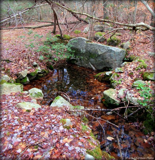
This hike in the Watuppa Reservation can be a bit tricky if you are not paying attention to your surroundings at trail intersections, otherwise, it is a fairly easy and rather peaceful stroll along trails less used. Starting from the parking area along Indian Town Road near the intersection of Yellow Hill Road you will want to look for the trail head with the sign for the “Brightman Trail to Watuppa Reservation” (Due note there are two other trail heads here that you will ignore). Once you are on the narrow trail you will find yourself winding under a canopy of tall oaks and pines. This trail ends at the much wider Indian Turn Trail and there is a “KP9” trail marker here. Be sure to be aware of your surroundings here as you will be looking for this turn on the way back. Turn right and follow the much wider trail for about two tenths of a mile to a very wide open four way intersection (KP8). Along the way look for the gnomes! Turn right here and almost immediately veer to the right (KP16) onto the Hidden Trail. You will follow this trail to the next intersection (KP21). The original plan here was to continue straight along the aptly named Hidden Trail but that is almost impossible as the trail narrows substantially and all but vanishes. Unfortunately, that leads to a little bit of road walking, but it is a quiet road nonetheless. So here at KP21 turn right onto the Temperance Trail and follow it easterly until the next intersection (KP22). Veer left here onto Abrams Path passing a gate just before Yellow Hill Road. Turn left here and follow the paved road to the next gate (G109) on the left. This is Deadman’s Trail. It is wide and winds westerly and downhill passing towering pines and beech trees that hold their dead sun glistened leaves well into winter. There are a few boulders scattered among the forest floor. Another trail comes in from the right (KP19), continue ahead and downhill to the next intersection (KP18). Stay to the left here and almost immediately you will want to turn left again (KP17). You are now back on the narrower Temperance Trail. It climbs uphill slightly before coming to the Hidden Trail once again (KP21). From here you will turn right retracing your steps back to the parking area, turning left at KP16, left at KP8, and finally left at KP9.

Map can be found at: Deadman’s Temperance.

TWRI-DMT01

Along Deadman’s Trail

Copicut Reservoir – Fall River


This is a very short walk on a peninsula that is just under a half mile in total. This location, used mostly by fishermen, offers a short trail that reaches to the end of the peninsula. The views of the reservoir are spectacular and makes it well worth the stop if in the area. Be on the look out for several types of birds here that visit the reservoir.

TWRI-CopRes02

A Thawing Copicut Reservoir

King Phillips Spring – Fall River

  • King Phillips Spring – Watuppa Reservation
  • Blossom Road, Fall River, MA
  • Trailhead:  41°42’56.24″N, 71° 5’19.86″W
  • Last Time Hiked: December 15, 2019
  • Approximate distance hiked: 2.6 miles
  • Fairly easy with some slight elevation.


This 2.6 mile loop starts and follows the route of the Homestead Loop Trail before breaking off and heading east into the depths of the Watuppa Reservation. Starting from a parking area surrounded by a split rail fence follow grass covered cart path away from the road. On the right before the stone wall and power lines is the trail. The trail is first flanked on the left by the stone wall. A few hundred feet ahead the trail passes through the wall and then to a split. Staying to the left you will see the first trail marker (marked by a rabbit). You are on the Homestead Loop Trail at this point. The trail markers for this trail are at every tenth of a mile. There are no other blazes on this loop. The trail passes under the power lines before winding back into the woods. After passing some holly and small boulders you will come upon a trail on the right (marked by a bee). Ignore this trail for this hike and continue straight. You will soon enough come to another “rabbit” marker to confirm you are on the right trail. At the end of the trail you will come to a fire lane where you will turn left. First find a sign on a tree with “KP3” on it to confirm your location. For the remainder of this hike you will want to look for these signs. The trails are not blazed otherwise. Following the fire lane known as Brightman Path you will pass through a swamp before coming to a small pond and what appears to be a small levee on the left. Continuing ahead the path starts to climb uphill. At the next intersection (KP7) continue straight onto the Indian Turn Trail which continues to climb uphill. At the top of the hill is a four way intersection (KP8). Turn left here and within a few hundred feet you will bear to the left (KP16) and start a slow descent. Keep an eye to the left for a wide path. It is a dead end but it takes you to the highlight of this hike, King Phillips Spring. The spring with a large rock surrounding by a cluster of smaller ones is the headwater of Blossom Brook. Take some time here to linger before heading back up to the main trail where you will turn left to continue to make your way to intersection KP17. Bear to the left here and again bear left at the next intersection (KP18). The trail now starts to wind downhill a bit coming to what appears to be a cellar hole on the right. From here the trail bends to the west and narrows quite considerably as it passes through a swamp once again. This stretch, called Corduroy Path, offers very thick shrubs, hemlocks, and junipers. Stop and listen for the birds as it is a haven for them. The trail then passes under the power lines again, back into the woods, pass a gate and ends at Blossom Road. Turn left here and follow the road pass the Reservation Headquarters and over a much wider Blossom Brook. The parking area is a few hundred feet ahead on the left.


Map can be found at: King Phillip Spring.

TWRI-KPS09

King Phillips Spring


Homestead Loop Trail – Fall River

  • Homestead Loop Trail – Watuppa Reservation
  • Blossom Road, Fall River, MA
  • Trailhead:  41°42’56.24″N, 71° 5’19.86″W
  • Last Time Hiked: October 20, 2019
  • Approximate distance hiked: 1.2 miles
  • Fairly easy.


Starting from a parking area surrounded by a split rail fence follow grass covered cart path away from the road. On the right before the power lines is the trail. The trail is first flanked on the left by a stone wall. A few hundred feet ahead the trail passes through the wall and then to a split. Staying to the left you will see the first trail marker (marked by a rabbit). The trail markers for this hike are at every tenth of a mile. There are no other blazes on this loop. The trail passes under the power lines before winding back into the woods. After passing some holly and small boulders you will come upon a trail on the right (marked by a bee). Ignore this trail for this hike and continue straight. You will soon enough come to another “rabbit” marker to confirm you are on the right trail. At the end of the trail, turn right onto the wide grass road and look for a trail on the left. Turn onto this trail and continue with the loop. At 0.3 mile marker there is a rather impressive holly tree. The trail winds a little further south and back west coming to a trail intersection just before the power lines. The trail to the right is the “bee” marked trail. Stay to the left here making your way to the power lines. The trail can be a little overgrown here. Continue ahead here passing under the lines and the trail becomes much clearer at the tree line. The next feature of the trail is a boardwalk (still under construction) before coming to the wide grass road once again. From here continue straight as the trail winds back to the first marker. From the first marker retrace your steps back to the parking area.


Map can be found at: Homestead Loop Trail.

TWRI-Home03

Marker Along The Homestead Loop

Freetown North – Freetown

  • Freetown North – Freetown/Fall River State Forest
  • Slab Bridge Road, Freetown, MA
  • Trailhead:  41°46’40.01″N, 71° 2’29.59″W
  • Last Time Hiked: June 30, 2018
  • Approximate distance hiked: 4.5 miles
  • Fairly easy.


Three and a half years ago I ventured into the southern part of the Freetown State Forest to do a hike. It was a cold and icy day in mid December of 2014. I finally made my way back to explore some of the trails in the northern part of the forest. This hike, early in the morning to beat the heat, made for a very sweaty adventure on a very warm and humid morning. Starting from the main parking area off of Slab Bridge Road we made our way up the entrance road back to the fire barn and then turned left onto the dirt trail named Payne Road. We followed this road passing a CCC watering hole on the right. Shortly after the watering hole and again on the right we came upon a blue blaze on a trail marker. We turned right here and followed the narrow and winding Massasoit Trail. This trail is rocky and rooted in areas and crosses a small stream. We followed the trail to its end then turned left on to Hathaway Road. There are several side trails off the main roads here but the remainder of the hike is on old forest roads. At the next major intersection of forest roads we continued straight staying on Hathaway Road passing two more watering holes. We also observed along this stretch mosquito traps that are used to test the pests for West Nile Virus and EEE. At the next major intersection we turned right onto Makepeace Road and followed it past the intersecting orange trail before going over a slight hill. Just over that hill we turned left onto the Bent Rim Trail which is marked with a sign. For the remainder of this hike we continued straight ahead followed the Bent Rim Trail as it winded through the forest ignoring all side paths and roads until we reached a trail on the left just before the gate at Slab Bridge Road. This trail leads you back to the parking area.


Map can be found at: Freetown North

TWRI-FSFN05

Old Forest Roads

Freetown South – Freetown/Fall River

  • Freetown South – Freetown State Forest
  • Bell Rock Road, Freetown, MA
  • Trailhead: 41°45’33.32″N, 71° 4’17.59″W
  • Last Time Hiked: December 14, 2014
  • Approximate distance hiked: 3.8 miles
  • Fairly easy with some elevation.


EXERCISE EXTREME CAUTION NEAR THE EDGES OF THE CLIFFS.


I ventured into the Freetown State Forest for the first of three planned hikes. This morning I choose to do the southern end of the forest. I was joined by a small group of hikers. We started from a parking area along Bell Rock Road. There are two trail heads here. We took the one by the large sign at the south end of the lot. The trail here is short, narrow, and well rutted from ATV use. It leads to a dirt road named Haskell Path. At the end of the trail we came to a gate. We turned right onto Haskell Path and followed it slightly downhill to a four way intersection with gates, passing several side trails we ignored. At the four way intersection we turned left onto a trail named Ledge Road. The road continues downhill and is flanked by the forest. We soon approached a fork in the road. We stayed to the left and continued to the a small stone bridge that crosses Rattlesnake Brook. (The road to the right would be our return route). After crossing the brook, and crossing briefly into Fall River, the road begins climbing, passing several side paths, as well as the Pond Trail and the Mothers Brook Trail. The road, well worn from the weather in areas, passes through areas of beech and pine trees. At the top of the hill a large area of ledge appears on the right. Use caution in this area. We explored the area enjoying the overlook. The view to the east looks over the pond below and the forest as far as the eye can see. We then returned to the road continuing north and started gradually going downhill. We then took a right onto the next road followed by another almost immediate right. This road leads to the shore of the pond. From here you get a good perspective of how high the ledge is. Here there is an intersection where we would turn left. However, we explored the short road along the edge of the pond before continuing. There are a few spots to enjoy the view here and there is a waterfall as well. We then turned left at the intersection and continued the hike crossing Rattlesnake Brook once again. Shortly after the brook we encountered another fork. The trail to the left is the Wampanoag Path. We stayed to the right passing a rather large gravel pit on the left before reaching the first fork we encountered. Here we went left and retraced our steps back to the parking area.

Trail map can be found at: Freetown South.

The Ledge and Pond

The Ledge and Pond

Tattapanum Trail – Fall River

  • Tattapanum Trail
  • Wilson Road, Fall River, MA
  • Trailhead: 41°44’10.91″N, 71° 6’11.73″W
  • Last Time Hiked: August 28, 2014
  • Approximate distance hiked: 1.0 mile
  • Easy with slight elevation.


This loop trail in the woods of Fall River abuts the North Watuppa Pond. The trail begins from a small area for parking along the edge of Wilson Road. After passing the gate, a fellow hiker and I followed the trail to the split. At the split there is a sign with a brief history of the property and its namesake. We followed the trail to the right meandering through a fern covered forest of pine, birch, maple, oak, and holly trees to name just a few. We also stumbled upon some survey monuments with the letters “RC” inscribed in them. The “RC” is an abbreviation for the Reservoir Commission. After passing the Cobble Crossing and some stone walls we came to the East Look. Unfortunately at this time of the year the leaves on the tree prohibit a good view of the pond below. We then continued along the loop slightly uphill into a thick of a pine grove. From here we made our descent down to the split then retracing our steps back to the car.


I did not find a trail map on-line.

Along The Tattapanum Trail

Along The Tattapanum Trail

Ridge Hill – Dartmouth

  • Ridge Hill Reserve
  • Collins Corner Road, Dartmouth, MA
  • Trailhead: 41°41’39.40″N, 71° 1’18.57″W
  • Last Time Hiked: June 18, 2014
  • Approximate distance hiked: 3.6 miles
  • Moderate due to narrow and rocky trails in areas. Some elevation as well.


This was my first hike in Dartmouth in a couple months. Ridge Hill Reserve is in northern Dartmouth near the Fall River line. I was joined by a friend who works in Dartmouth for this hike. We started this hike a little later than what I would normally start a hike, so I had to keep daylight in mind. It really wasn’t an issue as we are now in the longest days of the year. We started this hike by exploring the red trail. This trail, with the exception of where it comes out to the dirt roads and the old power line clearings, is very narrow as well as rocky in areas. For the most part it is well marked, however you should keep an eye out for the blazes at intersections. There is also an old mill site along the trail. After completing the red trail we decided to explore parts of the blue and green trails. Keeping the time in mind we opted not to do the entire green trail loop and we cut it in half using the blue trails. These trails were substantially wider. There is a section of the green trail that borders the New Bedford Rod and Gun Club. There are several no trespassing signs along this stretch for obvious reasons. After making a loop we returned to the car. We did come across a snake here and several birds as well as a great blue heron.


Trail map can be found at: Ridge Hill.

A Trail At Ridge Hill

A Trail At Ridge Hill

Copicut Woods – Fall River

  • Copicut Woods/Miller Brook Conservation Area
  • Indiantown Road, Fall River, MA
  • Trailhead: 41°42’32.22″N, 71° 3’54.30″W
  • Last Time Hiked: May 14, 2013
  • Approximate distance hiked: 4.2 miles
  • Fairly Easy


Most people do not know that a large section of Fall River is wooded. Copicut Woods is a good example of this. This hike made for a nice, well… stroll through the woods. Starting at the parking lot at Indiantown Road, I crossed the street and started following the Shockley Trail. Before the trail crosses the next road there is quite of beech trees. One of the nice features of this hike was that the trail intersections are numbered. I crossed Yellow Hill Road at intersection 2 continuing to the end of the trail. I then turned right at intersection 3 following the trail over the first of several stone bridges. This trail led to an old homestead where there are remains of a barn and house. I turned left at intersection 6 then right at intersection 7. Before me was a long road with a canopy of trees and stone walls on each side. This is Miller Lane and I followed it to intersection 10 where I turned left. I would suggest going by intersection 11 for now, turn left at intersection 12 (not marked on the map, and the path that continues forward is just a utility easement) and follow it down to a stone bench by the Miller Brook. Beyond this point there is not much. The path will come out to a small parking area and there are no good views of the reservoir. From the stone bench I made my way back to intersection 11 and turned right there following the trail to intersection 12. I then turned left, right at 7, then left at the “Ed Shed”, and finally right to retrace my steps back to the car. You could add more distance to this hike if you include the Horseshoe Trail.

Trail map can be found at: Copicut Woods

Miller Lane

Miller Lane