Archive for January, 2014

Roger Williams Park – Providence


A Sunday morning walk in the park. It was a very quiet morning in one of Rhode Islands busiest parks. In the summer this park (and adjoining zoo) is bustling with hundreds of people. Today I felt alone. Using the route for the most part in Ken Weber’s “More Walks And Rambles In Rhode Island” I started near the main entrance at Elmwood Avenue and started following an old concrete sidewalk near the Victorian Rose Garden heading toward the large mansion looking structure with large pillars. This structure is the Casino. It was built in the 19th century and has hosted several events during its day including weddings and balls. I then followed a path to the right of the Casino which lead to a flight of stairs that led to the Bandstand. At the this point I turned left and followed the path along the pond. I continued following the path by a fence before crossing a bridge. After the bridge I took a right to continue following the ponds edge. On the left I passed the Japanese Garden. The path is now more of a road that turns to the left and uphill away from the pond. At the end of the road I crossed the street and continued walking straight across a hilly grass area. Ahead is a rather large structure on the shore of another pond. It is the Temple of Music. My luck, there was a young woman practicing her singing and acoustic guitar playing. She was not aware she had an audience at first. She sounded very good and the acoustics of the temple were spectacular. I then turned in a northerly direction making my way uphill and through and area of trees until I came to the road. I turned right at the road and followed it to its end. At the intersection is the Boat House. I then turned right and followed the road that goes by first the Botanical Center and then the Providence Police Mounted Command facility. Here I saw a few of their horses out and grazing. After crossing the bridge, I took the path on the left which follows the edge of the pond for quite a while. This path, mostly naturally worn, meanders through an area of trees. There are signs here cautioning you of the presence of poison ivy. At the end of this path it opens to a grass area with another pond directly in front of you. If you go left here you can cross the bridge to get to the carousel. I went right instead following the edge of the pond and stopping to photograph some ducks. Uphill and to the right you will see the Museum of Natural History. At the road I turned left crossing the bridge following the winding road back towards the main entrance where I had parked the car.

I did not find a park map on-line, however more information is available here: Roger Williams Park
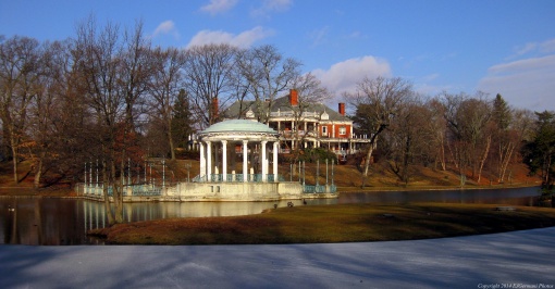
The Bandstand With The Casino Behind It

The Bandstand With The Casino Behind It

Arkwright Riverwalk – Coventry


After a very short walk at the Phenix-Harris Riverwalk I made my way to this walk. It is another rail to trails site. The walk starts at a small parking lot on Hill Street and follows small streams. The path in this area is rather root bound. In a bit the path widens and other paths down the hill appear. I continued straight passing a dam until I reached the end near the ruins of an old New England factory. I then retraced my steps for a while before exploring the lower trails closer to the river. I then made my way back to the main trail and back to the car.

I did not find a trail map on-line.

Dam Near Harris Mill

Dam Near Harris Mill

Phenix-Harris Riverwalk – West Warwick/Coventry


The last few weeks I have been exploring several bike paths and rail to trail sites in the area. This morning I was in the Coventry area checking out two more. The first was the Phenix-Harris Riverwalk. It is a short walk that follows the Pawtuxet River between Fairview Avenue in West Warwick and Lincoln Avenue in Coventry. It is a former railroad bed wedged between a residential neighborhood uphill and the river downhill. After this walk I made my way upstream to the Arkwright Riverwalk. Apparently there are plans to connect the two at some time.

I did not find a trail map on-line.

Phenix-Harris Riverwalk

Phenix-Harris Riverwalk

Stillwater – Smithfield


The Stillwater Scenic Trail is an old railroad line converted into walking trail in Smithfield. I started this walk at a small parking area at Capron Road. The walking trail is fairly wide and is quite level. It runs along the edge of Capron Pond for a bit before you pass the rapids of the Woonasquatucket River. Just before the small dam is the remnants of an old railroad bridge that crosses the river. Continuing pass the dam the trail follows the shore of Stillwater Pond then goes under Route 116 before ending at Farnum Pike. There is parking available at this end as well. At this point I retraced my steps back to Capron Road. At Capron Road I took a short walk to the bridge to take a few photos of the dam at Capron Pond. This walk seemed to be a haven for birds on a very spring feeling morning.

Trail map and additional information can be found at: Stillwater.

Along the Stillwater Scenic Trail.

Along the Stillwater Scenic Trail.

Tongue Pond – Cranston


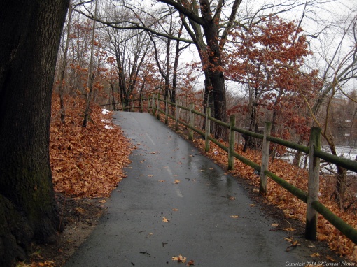
A while back I had stopped for dinner at the Texas Roadhouse in Cranston. I had noticed a walking path behind the restaurant. This morning while exploring relatively unknown walks in the Providence area I stopped and did this one. Parking at the restaurant (you could also park at Lowes) I started the rather short walk around the pond. The path is paved and is flanked most of the way with a post and rail fence. At the far end of the loop there is a connector path to the Cranston Bike Path (walk for another day). You could very easily add any amount of distance to this walk by utilizing the bike path. At the end of this walk I had a sudden craving for a sirloin… I indulged!

I did not find a trail map on-line.

Tongue Pond Path

Tongue Pond Path

Wanskuck Park – Providence


I went out this rather warm but damp January morning in exploration mode. I had a list of parks in the Providence area that were to have walking paths. My first two stops in Central Falls and North Providence I found were not worth blogging about. Stop number three was Wanskuck Park in Providence. Much to my surprise, this was a nice little park for a walk. The loop is a little over a half mile long. I started at the entrance gates and followed the main path through a large grass area with many large old trees. Just after the “brick stairs” a narrower path shoots off to the right. I followed this path (around a fallen tree) and pass an old chain link fence before the path widens again. The path veers to the right through a wooded area for a bit. At this point you are close to Route 146 and you can here the traffic. The path then continues out of the wooded area back to the entrance gate. I came across several people walking dogs here.

I did not find a trail map on-line.

Path at Wanskuck

Path at Wanskuck

College Hill – Providence


I started this New Years morning walk from the bottom of College Hill at the intersection of Benefit and Wickenden Streets. A very cold and quiet morning indeed being a holiday morning. I passed some of the oldest colonial era houses in the country as I made my way up Benefit Street. Many of them have plaques showing the date they were built. The architecture in this part of Providence is just downright beautiful. Along this stretch I also passed The Barker Playhouse, The Hoppin House, The John Brown House, The First Unitarian Church, The Superior Courthouse Building, and The Athenaeum before turning right and uphill on College Street towards the famous Van Wickle Gates of Brown Univeristy. At the top of the hill I then turned left on Prospect Street passing the Carrie Tower. The dome ahead is the First Church of Christ Scientist. I then turned left onto Waterman Street downhill back toward Benefit Street through part of the Rhode Island School of Design campus. There is a grassy area on the right with a sculpture in the middle. In warmer weather many RISD students are here sunbathing. It has become known to the locals as RISD Beach. Needless to say, no sunbathers today. When I got back to Benefit Street I turned right and followed it to Meeting Street passing behind The First Baptist Church and The Marine Corps Arsenal. At Meeting Street I turned right and followed it uphill to the end of the road. At the end of the road there is a set of stairs that lead you to Congdon Street. At this point I turned left and still uphill until I reached Prospect Terrace Park. At this park there is a statue of Roger Williams, the founder of Providence, that overlooks the city. From this vantage point you can see most of the city and its landmarks including the Rhode Island State House, Providence City Hall, The Biltmore Hotel, the steeples of The First Baptist Church and The Washington Trust Company, as well as the skyscrapers of the Financial District. After leaving the park I made my way up Bowen Street. After a block I reached the peak of this walk. The rest would be downhill. Bowen Street offered many home of various architecture as it skirted the Brown University campus. I followed Bowen Street to Thayer Street where I turned right. This stretch is usually bustling with activity. Again being early morning on a holiday, Thayer Street was as quiet as I’ve ever seen it. The next quarter mile is a cluster of small shops, eateries, and coffee shops. Although mostly corporate now there are still some Mom and Pop shops left here. I continued down Thayer Street through the heart of Brown University and followed it to the end at Transit Street. Again the architecture in this area is stunning passing several more colonial era homes. I turned left onto Transit Street before turning right onto Brook Street where another small cluster of shops are mixed with very old homes. I then turned right onto Wickenden Street passing several restaurants before making my way back to the car I had parked near Wickenden and Benefit Streets.

I did not find a trail map on-line.

Providence From Prospect Park

Providence From Prospect Park