Posts Tagged ‘ Salt Ponds ’

Town Pond – Portsmouth


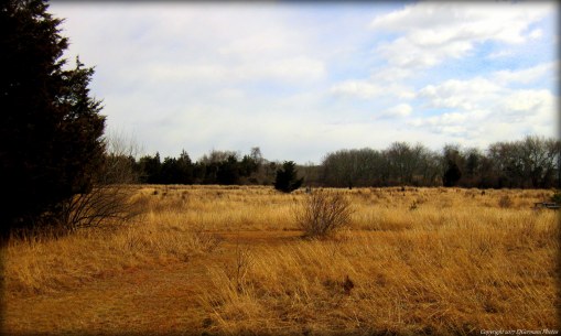
This out and back trail is well maintained and follows the west shore of Town Pond on one side and Founders Brook beyond the shrubs and thickets on the other side. The trail is accessible from an unmarked parking area on Anthony Road and the trail starts from the left side of the lot. The shrubbery along the trail serves as a haven for birds of all sorts. There are also utility poles here with nests for ospreys here. Hawks, owls, a great blue heron, ducks, and swans were all observed here at the time of this walk. The trail ends at the railroad tracks and across the way is the Bertha Russel Preserve which is essentially a tidal marsh protected for wildlife. This area is also significantly historical as this is approximately where Anne Hutchinson founded the colony which became Rhode Island in 1638. Founders Brook Park is nearby and has monuments commemorating the event.

TWRI-Founders2

From the end of the trail looking over the Russel Preserve

Moonstone Beach – South Kingstown

  • Moonstone Beach
  • Moonstone Beach Road, South Kingstown, RI
  • Trailhead: 41°22’18.72″N, 71°34’20.77″W
  • Last Time Hiked: April 17, 2017
  • Distance: Less than a mile April to September, up to 4 miles rest of year.
  • Easy Beach Walk.


Moonstone Beach for years was known for its reputation as being a nude beach. Today, no longer a nude beach, it is one of Rhode Islands most stunning beaches with its scattered stones along the sand. The beach surrounded and part of the Trustom Pond National Wildlife Refuge offers nearly 2 miles of strand between Roy Carpenters Beach and Green Hill Beach. The quiet beach is not easy to visit due to many seasonal restrictions. From May 1 to September 15 a parking pass is required to park along Moonstone Beach Road. Also in most of the spring and summer large sections of the beach are cordoned off to protect the piping plovers. The beach is stunningly beautiful in the winter months if you can handle the sometimes brutal winter winds. The best time to visit is very early spring, the autumn and winter. The beach is also noted for its birds as three salt ponds abut the beach including Trustom Pond and Cards Pond. Killdeers, Sandpipers, Herons, and Egrets are also known to frequent Moonstone. Be sure to bring a camera!!


More information about the birds of Moonstone Beach can be found here.

TWRI-Moonstone

Waves Crashing On Moonstone Beach

Pawaget Park – Charlestown


Once a driving range for practicing golfers is now a nice little pond side park just off the bustling Route 1. A half mile grass trail now winds through the area that was once the landing area for flying golf balls. Along the winding path are areas to picnic. The property also has a boardwalk and viewing deck that overlooks Ninigret Pond. A stone dust path back from the deck to the parking area makes for a shorter route back. The stone dust path, boardwalk, and deck are all ADA compliant.

twri-pawaget

Pawaget Park

Marina Park – South Kingstown


This aptly named park sits between the busy Route 1 and the marinas of Upper Point Judith Pond. The park has just about a half mile of paved pathways. There is an amphitheatre here by the edge of Silver Spring Cove. This park is dog friendly, but they must be leashed. Just across the street there are some benches overlooking the pond.


TWRI-MarinaPark

Marina Park

Quonochontaug Beach – Westerly/Charlestown

In the 20th century, Mother Nature dictated the fate of this beach. Much like Napatree, after the two hurricanes (1938 and 1954) it was decided that rebuilding would not be allowed here. The beach, nearly two miles in length, is a pristine stretch of natural beauty wedged between the village of Weekapaug in Westerly and Quonochontaug in Charlestown. It is a barrier beach that protects a salt pond. The beach and conservation area is in fact privately owned but open to walking. Be sure to follow the rules posted on the signs. I choose the beach today partly for two reasons. First, I would be in the area for a later engagement, and secondly, after weeks of relentless snowfall I wanted to find a place where I could go without snowshoes and get my feet back on the ground. It was a fairly warm day in comparison with a slightly cold breeze, but most importantly, it was a sunny day. I could easily see Block Island to the south. The sand dunes and most of the beach was covered in nearly a foot of snow but the tides had cleared a section to walk along. I parked in the first lot just off of Spray Rock Road and found a marked path to the beach. Then I headed east to breachway. There were only a few others out enjoying the scene here. I came across several cormorants and geese as well as seagulls. After reaching the breachway, I retraced my steps back to the parking area. Parking is very limited here. Therefore, off season visits are probably the best times to come here.

I did not find a trail map on-line.

Where Winter Meets Spring.

Where Winter Meets Spring.

Lathrop Refuge – Westerly


One of the smaller Audubon sites in Rhode Island, Lathrop offers a sweeping view of Winnapaug Pond. The trail, which is a cart path, starts at a small parking area along Shore Road. The cart path is flanked by several trees, shrubs, bushes, before entering an area of marsh. Needless to say I saw several birds here. After following the path to its end, I retraced my steps back to the parking area.

I did not find a trail map on-line.

Winnapaug Pond

Winnapaug Pond

Ninigret Refuge – Charlestown


Once an old Naval airfield that was used during World War II, Ninigret National Wildlife Refuge is now a place for hikers, photographers, and bird watchers. The property abuts the states largest coastal salt pond. I started the hike from the east parking lot first making a short loop along the coast near the end of runway 30. (The end of the runway is still here with its number clearly visible). The paths were still rather snow covered but very passable. I then made my way to Grassy Point. At the point there are sweeping views of the salt pond. There are some observation scopes here as well. From the point I retraced my steps until I got to the Cross Refuge Trail. Here I turned left and followed this trail to its end. Along the way I came across several deer track. Above were hawks, gulls, as well as several other birds including robins (first sign of spring). I then followed the shore of Foster Cove on its loop trail until I reached the west parking lot. From here I followed the Charlietown Runway Trail back to the east parking lot to finish the hike.

Trail map can be found at: Ninigret.

Ninigret Pond

Ninigret Pond

Trustom Pond – South Kingstown

  • Trustom Pond National Wildlife Refuge
  • Matunuck School House Road, South Kingstown, RI
  • Trailhead: 41°22’59.77″N, 71°35’7.49″W
  • First Time Hiked: January 19, 2013
  • Last Time Hiked: September 18, 2021
  • Approximate distance hiked: 2.4 miles
  • Easy.
 

I decided to wake up very early to get to Trustom Pond for sunrise. A decision that was well worth it for picture taking. The hike was not too cold until the wind picked up but it was bearable.  From the parking lot I went right along the Farm Field Loop Trail to get to the Osprey Point Trail.  I followed that to the end where there is an observation area that overlooks the pond. I then retraced my steps until I got to the Red Maple Swamp Trail.  I followed this trail to the end passing on the right an old windmill.  I then proceeded to turn right following the Otter Point trail to its end.  Again retracing my steps until I got to Farm Pond. Then I followed a path that wound through an open field that had one very wind blown tree in it and then back to the parking lot. I saw some wildlife as well along this hike. A few white tailed deer, red tailed hawk, several Canadian geese, and an osprey were all seen on this hike.

Trail map can be found at: Trustom Pond Trail Map

Trustom Sunrise

Trustom Sunrise

Lone Tree In A Field

Lone Tree In A Field