- Historic Fox Point
- India Street, Providence, RI
- Trailhead: 41°49’2.90″N, 71°23’48.24″W
- Last Time Hiked: May 28, 2023
- Approximate distance hiked: 2.8 miles
- City walk, some hills.
Fox Point, at the southern end of the East Side of Providence, has a deep and eclectic history dating back nearly four hundred years. The area was settled by the followers of Roger Williams, notably William Wickenden. The landscape has been altered drastically over the centuries as hills were leveled for development and the fill was used to expand the neighborhood east into the Seekonk River. Later industrialized, Fox Point drew immigrants from first Ireland, then Portugal and Cape Verde. The 20th century saw the neighborhood split by an interstate highway where whole blocks of homes and stores were bulldozed. Sections of the neighborhood were nearly abandoned before being revitalized into a premier waterfront park. Today, Fox Point is a vibrant neighborhood with many small shops, restaurants, and historical buildings. Every century of history is still on display here at Fox Point.
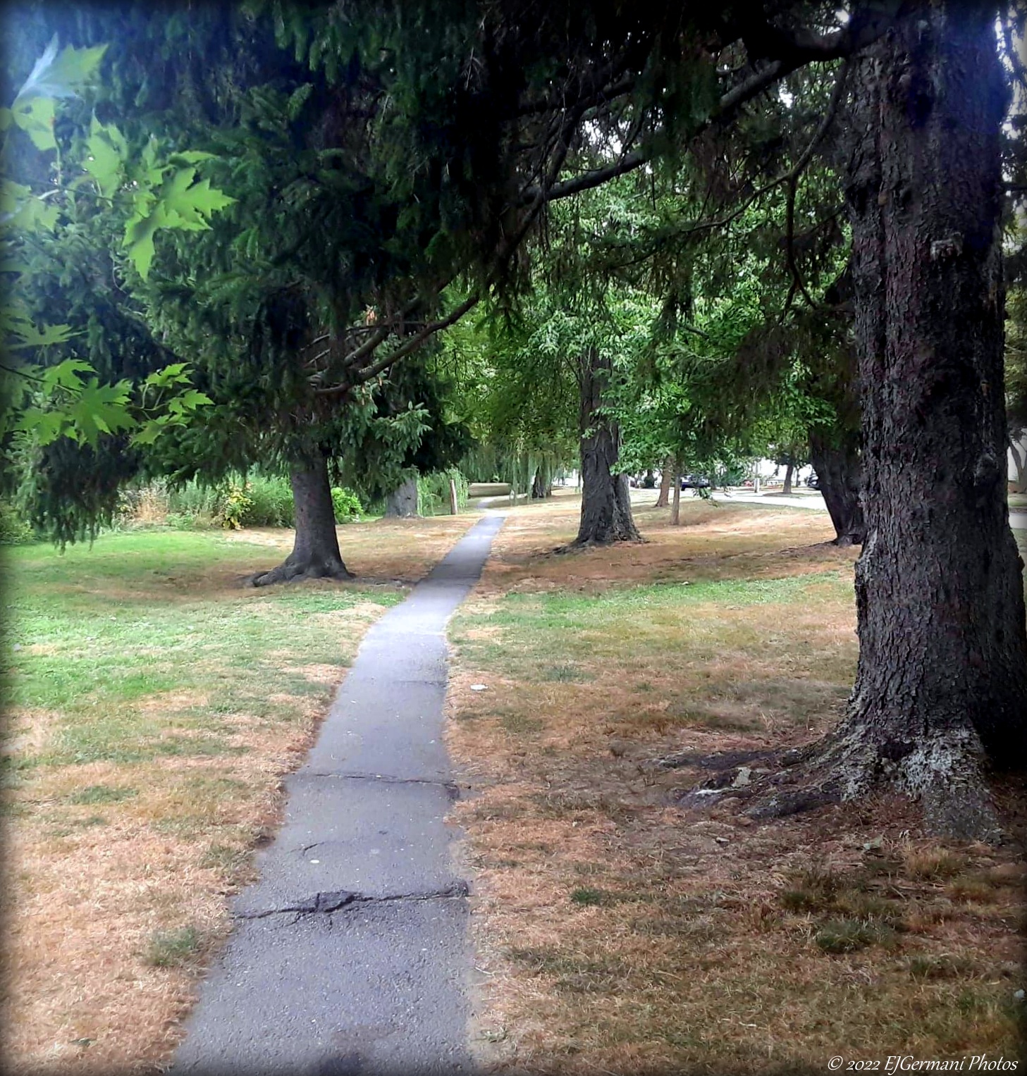
Starting at the entrance to India Point Park by the Community Boating Center, follow the paved walking path in the park closest to the road until you reach the steps that lead up to the India Point Park Pedestrian Bridge. It opened in 2008 and replaced a much older and narrower pedestrian bridge. The newer bridge, spanning over Interstate 195, serves as a small park in itself complete with ornamental lighting, gardens, and its signature compass in its brickwork . From the bridge you have a nice view of the upper reaches of Narragansett Bay as well as two of the cities iconic structures. The I-way Bridge, built at Quonset Point 15 miles south, was “floated” up the bay and put into place in August of 2006. The bridge opened in November of 2007 and carries the relocated Interstate 195 south of downtown. The bridge in total is 1,250 long with the main span being a 400 foot long network arch. The bridge is illuminated each night until 11 P.M. The bridge serves not only as part of the highway, but as an inviting “gateway” to the Downtown area. Just to the right of the bridge and across the Providence River are the iconic smokestacks of the Manchester Street Power Plant. This power plant originally built in 1903 was added to and converted to natural gas in 1995 and is one of the cleanest power plants in New England. It was once part of the sprawling Narragansett Electric property that consisted of several buildings along the river. From here continue across the bridge.
Congratulations! You have climbed Tockwotton Hill, one of the Seven Hills of Providence. Tockwotton is Native American for “steep ascent to be climbed”. Mostly leveled in the 1800’s, the material from the hill was used as fill for land east of Gano Street. The large brick building to your left is the former Tockwotton Home opened in 1864 as a home for aged women. In later years it became an assisted living facility before moving across the river to a larger modern building. Today, it is the home to the Roosevelt International Academy. For this walk turn left and follow George M. Cohan Boulevard parallel to the interstate. This road was once the main double lane throughway between the Washington Bridge and the Point Street Bridge. All of it except a portion of the west bound lane was removed when the Interstate was built in the 1960’s. The road is named after a playwright, composer, and producer who was born in Providence. The 1942 Academy award winning film Yankee Doodle Dandy depicts his life. Follow Cohan Boulevard for three blocks until you reach the bike path entrance opposite Thompson Street. Follow the short bike path along the edge of a small park that once part of the former Interstate 195 before it was relocated. At the end of the bike path you will catch a glimpse of the downtown Providence skyline. To your left (and across the off ramp road) you will see some of the newest buildings in the city which were built along the former highway corridor. Turn right here onto Alves Way then left onto Traverse Street.
The Catholic church here at the corner, Our Lady of the Rosary Church, was built in 1897. The building is well known for its twin stone towers with its spires which were added a few years later. The parish was founded in 1886 and is of mostly Portuguese descent. The parish hosts a feast usually in early August each year that unites the neighborhood. From here continue along Traverse Street to Wickenden Street. Turning right you are now on Wickenden Street. This street stretches along the strip of farmland once owned by the follower of Roger Williams, William Wickenden. Today the street is a bustling commercial district immersed by small shops, pubs, cafes, and restaurants mixed with tenement houses. Follow Wickenden Street several blocks to Hope Street where you will turn left. Along Hope Street you will start to walk by several older homes. On the right is 77 Hope, an eighteen unit apartment building that showcases the type of mid 20th century construction. On the left a block up is the 1853 St Josephs Church. The notable spire is visible throughout the area. Before turning right onto John Street take a peek down the street to the left. Here you will see the French American School Building built in 1920. The school offers bilingual courses from pre-school to eighth grade.
Turning right down John Street you will pass several houses built in the 1800’s over the next two blocks. Along the way you will pass 10 East Street (at the corner of John). The former Union Baptist Church built in 1876 is now a thirteen unit condominium. The current bell tower had a spire that was removed in the early 1950’s. When you reach the end of John Street you will see “Tea in Sahara” ahead of you. The Moroccan Cafe offers several teas and makes for a good spot for a break. Next turn right onto Governor Street then almost immediately left onto Fremont Street. Note the unique architecture of the home at the corner (63 Governor). Continue down Fremont Street, now mostly tenement houses to Ives Street. Turn left onto the bustling Ives Street, a neighborhood main road with small shops, a bakery, bars, and restaurants. Follow Ives Street one block then turn right onto Williams Street. Here you will get your first glimpse of one of the cities iconic structures. At the end of Williams Street is the park where Slate Rock is.
At this site was the original Slate Rock, several feet below at the original shoreline. Unfortunately the original rock was destroyed by workers trying to uncover it with dynamite. After, this small park, enclosed by wrought iron fence, was built to commemorate the site and event. This was the spot where Roger Williams, the founder of Providence (and Rhode Island), first landed in the limits of the current day city after being exiled by the Massachusetts Bay Colony. After being banished he traveled from Salem to Raynham before settling in current day Rumford. There he was told he was still within the charter boundaries of Plymouth Colony. He then left that site and made his way down the Seekonk River by canoe to this site before continuing to the site on North Main Street where he finally settled and founded Providence. It is said that this is where Roger Williams was greeted by the Native Americans with the phrase “What Cheer Netop” which is loosely translated to “Hello Friend”.
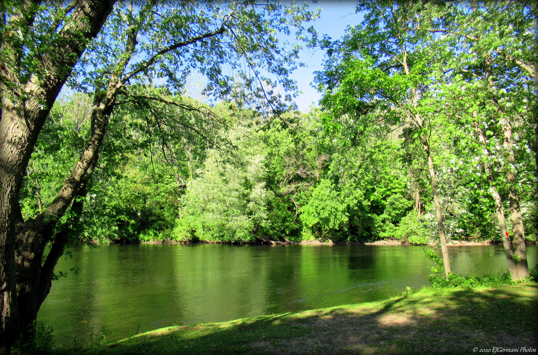
After walking through the park, cross Gano Street and follow Power Street into the Gano Street Park, first passing the Fox Point Community Garden (founded in 2006). Continue ahead through the parking lot to the bike path. Turn left and follow the bike path to the 1908 Crook Point Bascule Bridge. The 850 foot long rolling lift bridge, an iconic structure of the Providence skyline, closed in 1976. Trains from downtown would travel through the East Side Train Tunnel before crossing the bridge and making their way to points such as Boston, Bristol, and Fall River. There are currently plans to renovate the bridge, but a recent fire has put that into question. Retrace your steps back along the bike path. It will lead you all the way back to India Point Park via the shore of the Seekonk River. The bike path then passes along Gano Street Park once again and its ball fields. There is an informational board along this stretch that explains the history of the park and nearby area. Across the river is the developing East Providence waterfront. You will also see two small islands, aptly named Twin Islands. Locals call them Cupcake Island and Pancake Island which they resemble respectively. The river is usually busy with canoes, kayaks, boats, and the Brown University crew teams. The bike path then passes the Gano Street boat ramp before turning to the right and coming to Gano Street. The bike path then turns to the left crossing the exit ramp and follows the sidewalk area along Gano Street before winding under the Washington Bridge and into India Point Park.
The first Washington Bridge was built over the Seekonk River in 1793 built by John Brown. It was a covered drawbridge that connected Fox Point in Providence to Watchemoket Square in what is now East Providence. Folklore says that it was designed to be a covered bridge, being a longer crossing then most bridges of the time, so the horses crossing wouldn’t be “spooked” by the water. A storm destroyed this bridge and its replacement was built in 1807. The Great Gale of 1815 destroyed the second bridge and a third was built. Both the 1807 and 1815 bridges were covered drawbridges as well. In 1885, a steel span swing bridge was built and remained operational for 45 years. The 1930 Classical Revival style structure opened to traffic. The bridge has 12 arches and is 1,670 feet long. In the late 1960’s the bridge built to accommodate the west bound lanes of Interstate 195 was opened. Lastly, in 2012 the bridge carrying the east bound lanes was rebuilt and the facade of the original 1930 was preserved for the East Bay Bike Path/George Redman Linear Park. After passing under the bridge follow the bike path to its end and turn left onto an unnamed street. Follow the street to it end passing the Brown University Boat House on the left. At the end of the paved path at the river is a kiosk explaining Roger Williams travels along the Seekonk River. From here follow the paved path into the park along the river. You will soon come to the former location of the India Point Railroad Bridge. The bridge was originally built in 1835. It was the first interstate railroad bridge in America as East Providence was part of Seekonk, Massachusetts at the time. In 1882 a swing span was built. The bridge was last used in 1974 with the swing span being removed in 2001 and the remainder of the bridge removed in 2023.
Continuing to follow the paved path along the river will offer you sweeping views of where the Seekonk Rivers flows into the Providence River. Across the way is Bold Point Park and off its shore Green Jacket Shoal. The shoal has the remains of 29 ships from yesteryear that were scuttled here. Two of those were famed local steamships from the late 1800’s named the “Bay Queen” and the “Mount Hope”. It is often refereed to as the “Ship Graveyard”. You are now into the heart of India Point Park. The park has an interesting history of its own. It once served as a seaport, a crossroads, and lastly a metal scrap yard before becoming a waterfront park in the 1970’s. This area of the Providence Waterfront once served as a seaport for larger vessels that couldn’t make it to the docks closer to downtown. From the late 1600’s, ships carrying tea from India would arrive here, giving its namesake. The port was part of the triangualr trade, slaves, sugar, rum. By the 1800’s this port served the booming manufacturing businesses in the city. The docks here also served passenger steamships bringing people in from all over the east coast. India Point would serve as the city’s main port until it was moved to Allens Avenue where the present day Port of Providence is located. Shipping was not the only mode of transportation here. In 1835 the first railroad station to be built in Providence was located at India Point. It was built by the Boston and Providence Railroad. India Point would fall into decline after the 1938 hurricane and into disarray in the 1960’s. The area became nothing more than industrial plots mainly of scrap yards. In the 1974 India Point Park was dedicated and has become the largest waterfront park in Providence. Take some time to wander around and take in the sights here at the park before concluding your walk.

Slate Rock