Archive for July, 2018

Redway Plain – Rehoboth


Once used for militia training and also used to grow crops, this fairly large field off of Route 44 is today home to the Rehoboth Veterans Memorial and an occasional town event such as a carnival. Its name, Redway Plain, is derived from the early settler James Redway. For most of the year the field is left to grow and a walking path is mowed around its perimeter. Walking and horseback riding is welcome here along the perimeter. The recent addition of the Veterans Memorial pays homage to all the residents of Rehoboth who have served in all the American Wars from 1620 to current day.

TWRI-Redway2

Summer Day at Redway Plain

Cormier Woods – Uxbridge

  • Cormier Woods
  • Chapin Street, Uxbridge, MA
  • Trailhead:  42° 4’10.60″N, 71°35’41.86″W
  • First Time Hiked: July 15, 2018
  • Last Time Hiked: November 29, 2019
  • Approximate distance hiked: 2.6 miles
  • Fairly easy, some moderate hills.

There are several miles of trails here at Cormier Woods and the abutting properties. This hike focused on the main trails of Cormier Woods, which in themselves offer an abundance of solitude. Starting from the parking lot by the barn we first crossed the street and made our way to the red trail. At the intersection for the loop we turned left and followed the red trail clockwise first making our way through a narrow fern flanked path before passing a private residence and open field. The trail then winds back into the woods as it heads away from roads and residences. The further into the woods the quieter it would get. The red trail turns to the right as it approaches a swamp on the left and then winds through the western edges of the property coming to a boulder field. At the next intersection stay to the left and follow the blue trail downhill. It turns to the right a couple times and then climbs up a graded trail that looks as if it was once used as a cartpath or railway. At the top of the hill, just after a massive boulder, are a couple cellar holes of the Jonathon White Homestead. Continuing along the blue trail we soon came back to the red trail where we turned left and followed it clockwise steadily uphill for a bit. The trail winds passing ledges and several stone walls before coming to the first intersection. Turning left here returns you to the parking lot. From the parking lot we followed the yellow blazed trail clockwise as well. First through a meadow, then back into the woods. The white blazed trail on the left leads to several more miles of trails at Meadow Brook Woods and furthermore connects to the Mendon Town Forest. For this hike we kept it simple and continued along the yellow trail leading to a blueberry patch that was in bloom (and they were delicious). The trail turns to the right and leads towards the barn and back to the parking area. Hunting is allowed here, so blaze orange is required during hunting season. Deer, coyote, and fisher cat have been observed here as well.

Map can be found at: Cormier Woods

TWRI-Cormier02

Passing The Boulder Field

Brown House Glen Farm Trail – Portsmouth

  • Brown House Glen Farm Trail
  • Linden Lane, Portsmouth, RI
  • Trailhead:  41°33’17.53″N, 71°15’3.56″W
  • Last Time Hiked: July 12, 2018
  • Approximate distance hiked: 2.7 miles
  • Fairly easy, some small hills.


At the extreme northerly end of the Sakonnet Greenway on Linden Lane there are two kiosks. One is for the Greenway itself and the other is for the lesser known Brown House Glen Farm Trail. The route follows mostly roads and tree lines and is not overly defined. There are some trail markers, but they are far between. The walk itself covers some quite beautiful and historical property. Starting from the parking area directly across from the northerly terminus of the Greenway, walk east down the paved and aptly named Linden Lane. The narrow paved road is flanked by stone walls under a canopy of linden trees. To the right are the fields of the Newport Polo Grounds. At the intersection, continue straight passing an old house, known as the Red Cross House, on the left. The house was occupied by the farm superintendent and during World War II volunteers rolled bandages here. Continuing straight the road is now dirt, crosses a small brook, and bends to the right before coming to Glen Farm Road. Turn left here and follow the paved road to its end, passing a few residences along the way. Turn right onto Glen Road and almost immediately on the right is the path to the wooden footbridge. After crossing the bridge stay to your right and follow the tree line keeping the recreation areas to your left. Soon you will came to some old farm structures. Stay to the right here then continue to follow the tree line southerly, then easterly, before turning northerly making your way around a hilly field with a sheep shed in the middle. Soon you will come the kiosk at the far end of the trail. From here, turn left and follow the tree line (and power lines) up the hill back to the farm structures. From here continue straight retracing your steps back to the footbridge and Glen Farm Road. On the way back turn right at utility pole 11 and follow the dirt road into the barn area of the farm. This area is still active so use caution while exploring the area. Some of the buildings (not in use) are literally crumbling here and others are used for horses. The stone barns date back to the early 1900’s. The road then turns to the left passing an indoor rink to the left before coming to the Red Cross House once again. Turn right here and follow Linden Lane back to the parking area.

TWRI-Glen03

Glen Farm

Gilbert Stuart – North Kingstown

  • Gilbert Stuart Birthplace and Museum/Nature Trail
  • Gilbert Stuart Road, North Kingstown, RI
  • Trailhead:  41°31’12.35″N, 71°26’39.08″W
  • Last Time Hiked: July 6, 2018
  • Approximate distance hiked: 0.7 miles
  • Fairly easy, cost for admission.


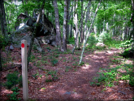
The very well known local gem, being that of the Gilbert Stuart Birthplace and Museum in North Kingstown, offers history, art, and nature. The museum consists of several structures including the house that Gilbert Stuart was born in. Mr. Stuart is known for painting nearly a thousand portraits of famous early Americans including George Washington. His depiction of the first President of the United States was used on the American one dollar bill. The house he was born in, built in 1750, showcases several replicas of his paintings. Furthermore, the house has a waterwheel and in the basement is a snuff mill. The adjacent grist mill, built a few years after the house, also has an operating waterwheel that powers the large grindstones that make corn meal. The gift shop/admission office features a back room that showcases art exhibits. In this room are a couple of Gilbert Stuarts paintings as well as a painting of Mr. Stuart produced by his daughter Jane. There is also a network of nature trails here. The trail head is just over the wooden bridge by an entry gate. The outer loop is blazed with a yellow dot and passes the colonial era Burlingame Cemetery. For this hike ignore the left turn ahead at the red dot connector trail and continue straight to the Carr Pond Overlook. Take a moment to take in nature here. You might catch a glimpse of a great blue heron above the pond that was formed from the dam at Gilbert Stuart. Continuing along the yellow blazed trail you will pass under a canopy of tall oaks and beech trees before coming to the green dot connector trail. Turn left here and soon you will come to the Hammond Cemetery with several gravestones dating back to the 1800’s. Continuing ahead you will pass an impressive New England style stone wall before coming to a three way trail intersection. Turn right here onto the blue dot connector trail. It will lead you back to the yellow blazed outer loop trail. At this intersection on the left is a rather deep cellar hole built upon a hill. To conclude this hike turn left onto the yellow blazed trail and follow it back to the museum. The trails here are only open when the museum is open and there is an admission fee for a guided tour of the buildings, gardens, and entry to the grounds. Be sure to check their website for hours of operation.

TWRI-GSt08

Gilbert Stuart Birthplace

Freetown North – Freetown

  • Freetown North – Freetown/Fall River State Forest
  • Slab Bridge Road, Freetown, MA
  • Trailhead:  41°46’40.01″N, 71° 2’29.59″W
  • Last Time Hiked: June 30, 2018
  • Approximate distance hiked: 4.5 miles
  • Fairly easy.


Three and a half years ago I ventured into the southern part of the Freetown State Forest to do a hike. It was a cold and icy day in mid December of 2014. I finally made my way back to explore some of the trails in the northern part of the forest. This hike, early in the morning to beat the heat, made for a very sweaty adventure on a very warm and humid morning. Starting from the main parking area off of Slab Bridge Road we made our way up the entrance road back to the fire barn and then turned left onto the dirt trail named Payne Road. We followed this road passing a CCC watering hole on the right. Shortly after the watering hole and again on the right we came upon a blue blaze on a trail marker. We turned right here and followed the narrow and winding Massasoit Trail. This trail is rocky and rooted in areas and crosses a small stream. We followed the trail to its end then turned left on to Hathaway Road. There are several side trails off the main roads here but the remainder of the hike is on old forest roads. At the next major intersection of forest roads we continued straight staying on Hathaway Road passing two more watering holes. We also observed along this stretch mosquito traps that are used to test the pests for West Nile Virus and EEE. At the next major intersection we turned right onto Makepeace Road and followed it past the intersecting orange trail before going over a slight hill. Just over that hill we turned left onto the Bent Rim Trail which is marked with a sign. For the remainder of this hike we continued straight ahead followed the Bent Rim Trail as it winded through the forest ignoring all side paths and roads until we reached a trail on the left just before the gate at Slab Bridge Road. This trail leads you back to the parking area.


Map can be found at: Freetown North

TWRI-FSFN05

Old Forest Roads