- Washington Secondary Bike Path
- Cranston, RI to Coventry, RI
- Last Time Hiked: 2018/2019
- Approximate Distance: 18.8 miles (open sections)
- Fairly easy.
Spanning 19 miles from a stones throw of the Providence border in a bustling and busy northern Cranston to the nearly desolate western end of the state, this bike path offers glimpses into central Rhode Island and its vast history and natural beauty. The Washington Secondary Bike Path, part of the East Coast Greenway, follows the former Providence, Hartford, and Fishkill Railroad as it winds through industrial areas, by shopping plazas, through suburban neighborhoods, pass old textile mills, along the Pawtuxet River with dams and waterfalls, and into the heavily wooded and secluded stretches of Western Coventry. The bike path was first opened in Coventry in 1997 and several sections in Cranston, Warwick, and West Warwick were added over the years. The western most 5 miles are under construction and is expected to open in 2020 making the total length 24 miles. There are a few rules to follow; walk on the left, bicycles stay to the right, and dogs must be leashed. This walk, like the Washington Secondary itself, is broken into six sections as to highlight each greenway along the way.

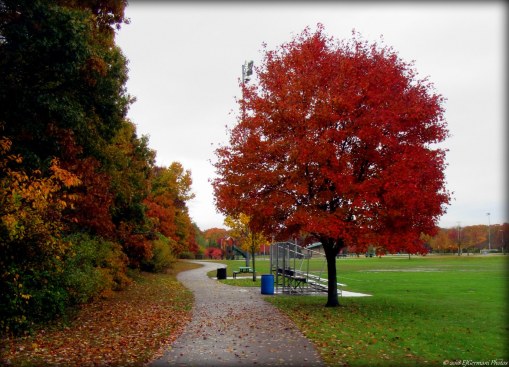
Along the Washington Secondary Bike Path in Cranston
~~~
- Cranston Bike Path
- Approximate distance: 5.6 miles
- Easy, entire leg is a paved bike path.
The first leg of the Washington Secondary Bike Path is the Cranston Bike Path. Built in three sections between 2000 and 2003, it winds nearly 6 miles along the former railroad. It starts from a parking area (41°48’4.65″N, 71°26’34.74″W) along Garfield Avenue just south of the Cranston Police Station. The bike path, well flanked by trees, follows the old railroad line south passing an office building on the left before coming to Tongue Pond. The pond, not visible from the bike path, is accessible via a paved path on the left. The bike path then passes behind the Lowes building before crossing Garfield Avenue. Use caution here (and at all street crossings) as it tends to be quite busy. Soon you will cross your first of several bridges. This bridge crosses over Burnham Avenue leaving behind the bustling shopping plazas of Garfield Avenue for quieter suburban residential neighborhoods for a bit. The next major crossing is Gansett Avenue. This time you will go under the road. Just after the bridge and on the left are the Cooney and Tate Fields, a city park with recreation fields and a walking path. There is parking here (41°47’14.82″N, 71°27’12.87″W) on Oak Street. Continuing ahead, you soon cross Dyer Avenue where there is a large “Cranston Bike Path” sign with all the info needed to know. The next bridge crosses the Pocassett River which starts in Johnston by Dame Farm and Snake Den and winds to the Pawtuxet River. Using caution, you will cross Park Avenue into the Knightsville neighborhood. The bike path now traverses through a neighborhood of light industrial, apartments, and commercial buildings before paralleling Cranston Street by the Public Library. Here you will cross Uxbridge Street back into mostly residential neighborhoods with some apartment buildings, then pass under the beginning of Oaklawn Avenue into the Meshanticut neighborhood. You will notice now that the bike path is in a valley between neighborhoods now. Keep an eye out to the right side, from this point forward as you will be able to catch a glimpse of an old telegraph pole once and again. These were typical alongside railroads back in the day. After passing the Greek Orthodox Church on the left (famed for its Greek Festival) you will pass under Dean Street continuing to parallel both Cranston Street to the right and Oaklawn Avenue to the left passing by their neighborhoods. Next you will cross Sherman Street, pass under the Route 37 overpass into the Oaklawn neighborhood, and meander along the backside of several strip malls and businesses on the left along Oaklawn Avenue. You are approaching Oaklawn Village just before the next bridge where parking (41°44’48.93″N, 71°28’46.64″W) is available. The bridge crosses Wilbur Avenue and shortly on the right is a trail head for the Woodland Trail. This trail leads back down to Wilbur Avenue. Continuing ahead you will soon cross over the Meshanticut Brook in a fairly wooded area. Take a peek along the right side of the bridge. There is an old railroad marker/signage here at the bridge. The brook down below is quite pretty and the wooded area offers a haven for many birds. Ahead the bike path crosses under New London Avenue (Route 33) into another wooded area west of the Pontiac neighborhood. Just before the large metal building on the left you leave Cranston. From here to the parking lot under Interstate 295 (and beyond to the Pawtuxet River), the town line between Warwick and West Warwick follows the former railroad right of way, Warwick to the left, West Warwick to the right. At the bridges that carry Interstate 295 over West Natick Road are two large dirt parking lots (41°43’45.14″N, 71°29’4.18″W). This is the end of the Cranston Bike Path.

The Cranston Bike Path passing under Gansett Avenue.
~~~
- Warwick Bike Path
- Approximate distance: 1.6 miles
- Easy, entire leg is a paved bike path.
Continuing beyond West Natick Road and under Interstate 295, the Cranston Bike Path becomes the Warwick Bike Path. This section, just over a mile and a half, was built in 2003. The bike path for the next couple hundred feet is flanked by post and rail fence before coming to a steel truss bridge that crosses the Pawtuxet River. This is the first of several crossings of the river along the Washington Secondary Bike Path. After crossing the bridge you are now in the East Natick neighborhood of Warwick. Just ahead on the left is Tirocchi Field complete with ball fields, a canoe launch, and a trail that leads to the river. Parking is available here at the park (41°43’22.7″N 71°29’07.4″W). Beyond the park is a row of mill houses on the left and then the East Avenue crossing. After crossing the busy street take note of the sign explaining the history of the Village. The bike path then continues southerly through mixed industrial, commercial, and residential neighborhoods paralleling Bald Hill Road before passing a trailer park. From here the bike path slowly curves to the west, again flanked by post and rail fence as well as some small areas of ledge. At the next street crossing, Providence Street (Route 33) is the city line. This is where the Warwick Bike Path ends.

Crossing the Pawtuxet River
~~~
- West Warwick Greenway
- Approximate distance: 2.6 miles
- Easy, entire leg is a paved bike path.
After crossing Providence Street you are now on the West Warwick Greenway. The first section from Providence Street to Hay Street was built in 2000. The remaining 2 miles through West Warwick was built in 2003. The Greenway first passes the backside of small industrial and commercial businesses along Providence Street on the left and a small residential neighborhood on the right before coming to the Bradford Soap Works complex. The newer factory building is to the right, but the much older and historic mill building is on the left at another bridge that crosses the Pawtuxet River once again. Technically this is the South Branch of the Pawtuxet, as the river joins with the North Branch slightly downstream. The mill building, with a date of 1889 inscribed on it, is a multi story stone structure with an adjacent dam and waterfall clearly visible from the bridge. Being a manufacturer of soap, the air in the general area smells quite pleasantly “soapy”. After crossing the river Hay Street is just ahead. This is the entrance to Riverpoint Park where parking (41°42’56.6″N 71°30’56.9″W) is available once again. Also here at Hay Street, it is worth taking a peak to the left a couple hundred feet to check out the New Haven Caboose. Continuing ahead, the tennis courts of Riverpoint Park will be on your right and the backside of the West Warwick Public Works Facility will be on your left as the bike path starts to turn to the south and then cross over East Main Street. Passing through a neighborhood first, the bike path will come to Providence Street once again at Arctic. Just after crossing the street is a kiosk on the left with information about the East Coast Greenway, complete with distances to the terminus at Calais, Maine and Key West, Florida. From here the bike path flanks the South Branch Pawtuxet River once again briefly before turning toward the west, passing through areas of ledge, and then under Main Street. Continuing ahead through a narrow area you soon cross Brookside Avenue. After crossing the street the bike path continues straight flanked by post and rail fence for a little over a half mile before reaching a mile marker at the town line between West Warwick and Coventry. Just after the West Warwick Avenue (Route 117) overpass is the Coventry Greenway sign.

Bradford Soap Works Building Along The South Branch Pawtuxet River
~~~
- Coventry Greenway
- Approximate distance: 4.3 miles
- Easy, entire leg is a paved bike path.
The next section of the Washington Secondary Bike Bath is the Coventry Greenway which was built in three sections between 1997 and 2010. The Greenway starts at the West Warwick line and continues to a point 4.3 miles west. It is maintained by the Town of Coventry. Continuing from the end of the West Warwick Greenway at the town line you will first pass on the left the Matteson Pond Recreation Area. Here along the bike path is a small park area with a short path and park benches. Beyond the park area through the woods is the actual pond. The bike path then crosses three streets (Whitford, Pulaski, and Quidnick) passing the Rhodes Pharmaceuticals factory on the left. Continuing ahead the bike path crosses the South Branch Pawtuxet River once again, this time at Clarion Falls (to the left). Just after the river crossing, also on the left is the famed Nathanael Greene Homestead. There are trails here to explore if you care to and are accessible from the bike path. A kiosk has been recently installed here. On the right just before crossing Laurel Avenue is the former Anthony Mill along the South Branch Pawtuxet River. It is now a residential complex. On the left is a former platform from yesteryear when this was a railway. There are some tracks at the other-side of the platform. After crossing Laurel Avenue there is a parking area on the left (41°41’40.5″N 71°32’51.4″W) and a kayak launch for the South Branch Pawtuxet River on the right. An old railway station platform is here as well between the bike path and the parking area. Continuing ahead, the bike path crosses the South Branch Pawtuxet River one last time via another steel truss bridge before passing a couple streets. On the left is the entrance to the Merrill Whipple Conservation Area, which offers trails to the river. Also on the left is a cemetery just before the bike path crosses Main Street (Route 117) via another old railroad bridge. Pushing forward, The bike path passes behind the Coventry Police Station and the Cornerstone of Faith United Methodist Church. Here, up on the small bank, is a nice little spot to rest if so inclined. Next, the bike path crosses Holden Street and Station Street where there are parking areas on the right (41°41’32.6″N 71°33’52.4″W). After the parking area is another section of old railroad track. Along the way you will pass several sections, but this one is of interest because it is a switch. The bike path then passes Paine Field where more parking is available (41°41’34.4″N 71°34’05.4″W). Paine Field offers tennis courts, baseball fields, and basketball courts. The bike path then crosses Main Street once again. Be sure to use the crosswalk here as this is a busy crossing. Also, to the left at Main Street is an ice cream shop (Udder Delights). Next, the bike path passes behind the Coventry Senior Center before coming to another parking area (41°41’49.1″N 71°34’46.5″W) where the bridle trail begins. From this point westward the stone dust trail parallels the bike path occasionally crossing it and switching sides. Just before the Flat River Reservoir is a spur path on the right that leads to parking at the Coventry Library (41°42’04.7″N 71°35’36.7″W). You will get your first glimpse of Flat River Reservoir to the left by the Ayoho Campground. The bike path starts to move into a much more rural area of Coventry, well wooded on both sides. At Ayoho Road there is limited parking (41°42’03.5″N 71°36’00.6″W). After Whitehead Road, the bridle trail climbs uphill on the left for a bit before rejoining the bike path. Along this stretch the bike path passes through a some area of ledge. The remaining section of the Coventry Greenway is flanked by post and rail fence as it pushes westward toward the Trestle Trail which starts at a sign indicating that you are leaving the area maintained by Coventry Parks and Recreation Department.

The Coventry Greenway and The Bridle Path.
~~~
- Trestle Trail East
- Approximate distance hiked: 4.7 miles
- Easy, entire leg is a paved bike path.
The Washington Secondary Bike Path continues through the rest of Coventry as the Trestle Trail and is maintained by the State of Rhode Island. Built in 2014, the eastern section of it pushes through Western Coventry to the Village of Summit. Seamlessly continuing from the Coventry Greenway, the Trestle Trail passes through an area of tall pines before coming to an area for equestrian parking (41°42’14.8″N 71°37’08.2″W) at Pinehaven Road. Along the way there is a dirt pathway on the right that leads to Skip’s Creamery. After Pinehaven Road the bike path crosses two more roads before coming to the Flat River Reservoir once again at the Cheese Bridge. The bridge offers a good view of the narrow portion of the reservoir below. Continuing ahead the Trestle Trail crosses Hill Farm Road where there is yet another parking area (41°42’04.5″N 71°38’04.8″W) at Coventry Center. At the crossing, a large white brick building, once used to bleach fabrics, will remind you of the villages past. Pushing forward the trail now enters a much more secluded area as the parallel Route 117 pulls further and further to the north. To the left is the first glimpse of Stump Pond at a bridge crossing. Continuing, the bike path is flanked by post and rail fence and the bridle trail zig zags back and forth. As the bike path bends ever slightly to the right it passes through an area of preserved land. On the left is the Neylon Property and shortly thereafter on the right is the Beaudoin Property. After the 7.0 mile marker, on the left there is an opening in the fence line that leads to a right of way with a trail named Comstock Path. Just off the bike path here you will find the ruins of an old mill complete with a mill race and dam. Directly across from the fence opening and on the right is the terminus of the yellow blazed trail of the Beaudoin Property (a Coventry Land Trust property off of Ledge Road). The bike path pushes ahead crossing the Quidnick Brook, passing Williams Crossing Road, and then crossing Quidnick Brook again, coming to an area of brown stone ledge before climbing up to the intersection of Camp Westwood Road. It may seem odd that there is such a hill here for a former railroad grade, but “back in the day” there was a bridge here and the railroad passed under the road. After crossing the road, take a peek to the left. You may spot a large rooster (lawn ornament). Ironically enough, you are likely to hear them as well. The bike path now descends back to the original railroad grade, levels out, crosses another brook, and becomes narrower as it approaches the Route 102 (Victory Highway) overpass. The bike path is flanked by ledge again just before the busy highway crossing. After going under the bridge, the bike path starts the descend slightly passing a small pond on the left before coming to Log Bridge Road in the village of Summit. On the right is the famed Summit General Store. This is the end of the Trestle Trail East. Just on the other side of the road is a parking area (41°41’27.0″N 71°41’57.1″W) and kiosk with the history of the village. The bike path continues a few more feet beyond the parking lot and dead ends. This is where the Trestle Trail West will continue in the near future.

Trestle Trail East Approaching Route 102.
~~~
- Trestle Trail West
- Approximate distance hiked: To be determined
- Currently under construction and closed. Expected to open in 2020.
TO BE CONTINUED!!!

The Trestle Trail West Will Continue From Here in 2020!
I would like to thank Auntie Beak once again for joining me in another long distance endeavor.
Photos of the walk can be found on the Trails and Walks Facebook page.