Archive for September, 2016

Block Island Greenway – New Shoreham

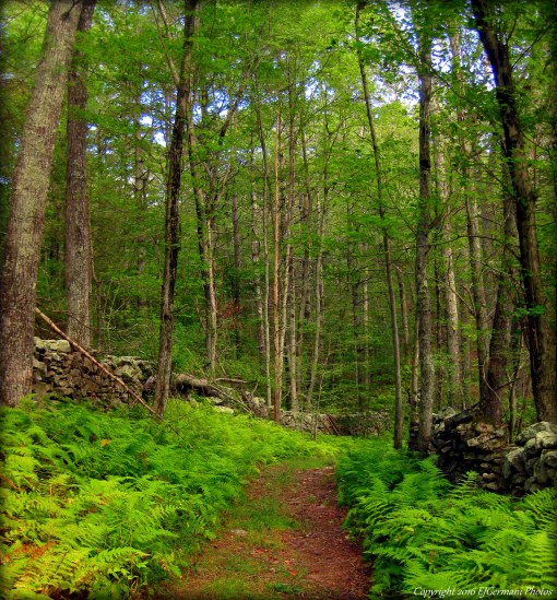
The Block Island Greenway stretches from the Great Salt Cove through Rodman’s Hollow to Payne Farm traversing over some of the highest points on the island. There are several loops and side trails that make up the Greenway as well. For this hike, which starts at the ferry dock, 6 miles of the Greenway is covered as well as three miles of road walking to get to and from the Greenway trails. From the ferry, head to the road (Water Street), and turn right. You will pass several small shops and restaurants in the New England picturesque village. Note the National Hotel and the Surf Hotel, two sprawling wooden structures. The street then turns to the left and becomes Dodge Street. At the next intersection you want to continue straight onto Harbor Road. The road to the right (Corn Neck Road) leads to the northern end of the island. Soon you will be passing by some of the iconic Block Island watering holes, Poor Peoples Pub and Captain Nick’s. On the right you will catch a few glimpses of Harbor Pond before coming to the next intersection. Turn right onto Beach Road and then almost immediately left onto Ocean Avenue. After going downhill a bit you will catch a glimpse of the southernmost end of the Great Salt Cove to the right. Payne’s Donuts will be on the right just before you need to turn left onto West Side Road. Climbing up hill slightly, you will pass several fields encased in stone walls. On some days you may be greeted by cows. The road then splits. Stay to the left here and proceed along Legion Way. To the right is the American Legion hall. After passing the hall, cross the street and enter Island Cemetery. Follow the grass path up the hill of the cemetery to the dirt road. Turn right and then left to follow the road along the edge of the cemetery. Take your time here in the cemetery. There are several very old graves to check out and some very prominent names of the islands history including Payne and Champlin. After following the dirt road stay straight along the edge of the stone wall. Soon you will see a set of wooden stairs, known as a stile, that cross over a stone wall. You are now entering the Greenway at the Harrison Loop. The trail to the right, less than two tenths of a mile, is the extreme northern end of the Block Island Greenway. After crossing the stile turn left and follow the shrub and tree flanked, grass mown foot path. After crossing a driveway the trail continues to wind through the woods another half mile before coming to another dirt road. Follow the road ahead a few feet then turn right into a driveway. The Greenway continues to the right of a fence in garden with a “chef” in it. The trail then crosses a stone wall and turns right. After crossing the stone wall turn around and take a peek at the sign on the tree. The folks here on the island do have a sense of humor. The trail then zigzags another three tenths of a mile to Beacon Hill Road passing on the left a sprawling farm with horse, donkeys, and chickens. You will likely be greeted by them as you pass by. Beware of the fence though! After passing Beacon Hill Road, continue to follow the main trail ignoring side trails. The Greenway climbs uphill into Nathan Mott Park, Turnip Farm, and the Loffredo Preserve. A trail to the left, with stairs, is currently closed. Continue straight to a large open field. At the top of the hill you have sweeping views to the east of the airport and Old Harbor in the distance. Continue straight along the main trail keeping a large house to your left. When you reach a gate there is a trail to the right. Turn onto it and follow it. It loops back around and slightly uphill. Then turn left onto the next trail. This trail zigzags a bit as it heads west. At the next trail stay to the left. The trail soon passes another large open field before coming out to Old Mill Road. Three hundred feet after crossing the road you will find a bench along the trail. From here you can see Montauk Point 15 miles away. Montauk is the eastern end of Long Island, New York. On clear days you may be able to see the lighthouse that sits on the tip of the island. The Greenway trail then continues south to Cooneymus Road passing more open fields and crossing another stone wall. After crossing the road the trail winds into the entrance of Rodman’s Hollow. Turn right onto the dirt road known as Black Rock Road. It gently descends downhill pass rolling hills of wildflowers. Continuing straight and ignoring side trails you will see the ocean. At the end of the road the trail turns to the left and slightly uphill. There are two spots to take in the beautiful scenery of the southern shore of the island. The second spot, known as Tom’s Point, offers a bench to sit and rest. Be aware of the edge of the bluffs here. They are very steep and a fall will almost guarantee an injury if not more. After a break continue to follow the trail. It comes to a dirt road where you will want to turn right. In about four hundred feet or so look for a trail on the left and turn onto it. This trail winds through Rodman’s Hollow passing several shrubs including shadbush, which is spectacular when in bloom in May. A trail appears on the left, continue straight to the next intersection and stay to the right. The trail then drops down into the hollow before coming to the next intersection. There is a small sign here indicating the trail to Fresh Pond. Take a quick break here. The trail ahead can be downright strenuous to some. Though the section is short, less than a quarter mile, the elevation quickly climbs nearly one hundred and thirty feet. The trail then comes to a dirt road. Stop and take a breather! You will notice a granite post with directions. Follow the road north a few hundred feet and you will soon be back on a trail the leads through Peckham Farm and into the Fresh Pond Preserve. There is a short spur trail to the right along the way that climbs uphill for a view of the area.  After passing through Peckham Farm the trail passes a stone wall and turn lefts into a grass field. It continues downhill towards the trees then loops to the right and down almost to the shore of the Fresh Pond. Just before the pond is a trail to the left that leads over a small wooden bridge, briskly uphill, and then along a stone wall flanked field that overlooks the pond. The trail then comes to Lakeside Drive where you will turn right to follow the road. About two tenths of a mile ahead and to the left you will find another stile over a stone wall. Climb over it and continue to follow the trail, the Payne Farm Trail, as it winds through thick brush and open fields first through the Fresh Swamp Preserve before winding through Payne Farm and Sands Farm. The fields are covered in wildflowers and attract several bees and butterflies. At the end of the trail turn left onto Payne Road. This is the end of the actual Greenway. The remainder of the hike follows roads back to Old Harbor. Payne Road soon bends to the right passing the islands medical center and school. Turn left onto High Street and follow it as it winds down into town passing several homes along the way. Turn left onto Water Street and the ferry dock will be on the right. It is highly recommended that you obtain a copy of the trail map, and book as well, from the Nature Conservancy before taking on this hike. Though the island is only 7 miles long and 3 miles wide, taking wrong turns could add miles to your trek. Also, the island is very hilly. Be sure to bring plenty of water to stay hydrated.

twri-bi06

Signage Along The Greenway

twri-bi09

Rodmans Hollow With September Goldenrod.

Casey Farm – North Kingstown

  • Casey Farm
  • Boston Neck Road, North Kingstown, RI
  • Trailhead: 41°30’43.45″N, 71°25’23.07″W
  • Last Time Hiked: September 24, 2016
  • Approximate distance hiked: 4.1 miles
  • Fairly easy with some elevation.

Most locals know Casey Farm for its farmer markets (one of the best in the state). Others know the farm for being a historical site. What a lot of people are not aware of is that Casey Farm offers miles of trails. For this hike, I joined a small group attending a Rhode Island Land Trust Days event. The hike was led by the very knowledgeable Dr. Bob Kenney of the University of Rhode Island. Mr. Kenney, (a walking encyclopedia of birds, mushrooms, and plants) volunteers quite often for the U.S. Fish and Wildlife Service and the Audubon Society. In fact this is not the first of his hikes I have been on. In 1659, several colonists bought the land on Boston Neck for a mere 18 cents per acre from the Narragansetts. One of these families were the Richardsons. By 1702 half of that property belonged to the family that founded Casey Farm. The farm stretched from Narragansett Bay to the Narrow River as it still does today. The property, a working farm, is protected and owned by Historic New England. Atop the hill along Boston Neck Road is where the farm is located. It consists of several fields and structures including a large barn as well as old New England style stone walls. The first part of the hike took us into the eastern part of the property down to Casey Point. The old cart path passes through areas of wildflowers including wild snapdragon, black swallowwort milkweed, and heart leaved aster. There is also an abundance of ferns, mushrooms, and an invasive shrub known as devils walking stick. This area is also a haven for birds as we saw and heard catbirds, woodpeckers, and red tailed hawks. When we reached the point we had sweeping views of the west passage of Narragansett Bay. Across the bay is Jamestown and the large open field is part of Watson Farm (another Historic New England property). Beyond Jamestown you will see the Newport Bridge. To the north is the Jamestown Bridge and Plum Point Lighthouse. To the south you can see Beavertail Light and Dutch Island Light. After spending a little time on the point we retraced our steps back to the farm. From here we then followed another stone walled flanked cart path toward the heavily wooded western end of the property. We briefly entered the neighboring King Preserve, the newest Nature Conservancy property in Rhode Island. This preserve is a work in progress still. Most of the major trails are complete and open, however, there are a section of trails yet to be built. The trails are soft and there are boardwalks that cross wet areas and streams. There is plenty of ferns in this area among the birch trees and sassafras. We nearly reached the Narrow River at the bottom of the hill before making our way back uphill along old cart paths and dirt roads winding through the Casey Farm property. This stretch of the hike also offer sounds and sights of nuthatches, tufted titmouses, and eastern towhees. We then returned to the farm to conclude the hike. Casey Farm is open from June 1st to October 15th on Tuesdays, Thursdays, and Saturdays. There are also tours of the farm available. For more information please call 401-295-1030.

A note from the folks at Casey Farm:  Casey Farm is open to the public during daylight hours for hiking trails at Casey Point or those adjacent to King Preserve. Please note dogs must be on leashes, clean up of course, and respect the young people and farm animals by keeping dogs away from the farmyard and fields. Access Casey’s woodland trails via the King Preserve. Camp Grosvenor is not open to the public for hiking. Access Casey Point on Narragansett Bay via the gate on Boston Neck Road. We are working on getting better signage. Feel free to contact me with any questions: Jane Hennedy, site manager, 401-295-1030 ext. 5, jhennedy@historicnewengland.org.

twri-casey04

Casey Point with The Newport Bridge in the distance.

twri-casey06

Flanked by Wildflowers

Briggs Park – Cranston

  • Briggs Park/U.S. Senator John H. Chafee Athletic & Recreational Complex
  • Hope Road, Cranston, RI
  • Trailhead: 41°45’12.97″N, 71°30’43.32″W
  • Last Time Hiked: September 21, 2016
  • Approximate distance hiked: 1.0 miles
  • Easy.


In western Cranston there is a rather large athletic complex along Hope Road. The complex is home to the Cranston West Little League and several soccer fields. There is a half mile paved walking track around the largest field on the east side of the property. At the southern end of the walking path is a trail that leads to the west side of the complex and the nearby Hope Highlands Middle School. Exploring the trails and doing one lap on the walking path was just about a mile.

twri-briggs

Walking Path

Hanton City – Smithfield

  • Hanton City
  • Smithfield, RI
  • Trailhead: Undisclosed
  • Last Time Hiked: September 17, 2016
  • Approximate distance hiked: 3.3 miles
  • Fairly easy, slight elevation.


Yesteryear there existed a cluster of buildings in the woods of what is now Smithfield. This town was in an extremely remote area miles from any other towns or villages. The town was eventually abandoned and all that remains are several cellar holes, wells, and stone walls. It is known as Hanton City and there are several theories of why the town existed in the first place. Some believe that maybe the occupants were loyalists to the British throne during the American Revolution, others believe that maybe these occupants were diseased and forced to live away from the general public. Regardless, they had a small but fully functioning village in the remote woods of Northern Rhode Island. The properties in the area are owned by several different groups. Some of it is privately owned, some owned by nearby Fidelity. The rest is owned by the Audubon Society and the Smithfield Land Trust. The area is not open to the public and access is available occasionally when the Smithfield Land Trust leads guided group tours of the property.

twri-hanton04

Cellar Hole With Shelves


Dark Hollow Brook – Voluntown/Griswold

  • Dark Hollow Brook
  • Hodge Pond Road, Voluntown, CT
  • Trailhead: 41°32’28.76″N, 71°51’27.01″W
  • Last Time Hiked: September 16, 2016
  • Approximate distance hiked: 4.0 miles
  • Moderate due to navigation, some significant elevation.


If you like stone walls and ledges, this is the hike for you. I met with fellow hiker Auntie Beak for this mid afternoon hike in the Pachaug State Forest in Connecticut. She has done this hike on several occasions and it was nice to relax and just follow her lead. The trails here are not blazed, therefore it is recommended to obtain a copy of the map for the forest trails and use GPS. (If you use Auntie Beaks map, linked below, note that we did the southern portion of her overall hike). Starting from the parking area just west of Kinney Brook along Hodge Pond Road we followed the old dirt road south into the forest. The first part of this hike you will continue straight along the main road ignoring side trails. After climbing uphill for a bit we came upon an old stone building. The stone work is quite impressive. Continuing along the old dirt road, immediately following the stone building is an open field with flowers. It appears this might have once been a garden. Further ahead is a seasonal brook and waterfall to the right. Soon after there are some beautiful ledges as well. At the end of the road turn right and start heading northwest. You will start to see more impressive ledges along this stretch. At the next intersection merge to the left. The trail becomes much more primitive and narrow at this point as it meanders through a forest of rocks and boulders. Ahead, seemingly in the middle of nowhere, you will come to a bridge that crosses Dark Hollow Brook. At the next two trail splits stay to the left. You are now in the Town of Griswold. Ahead stay to the right, the trail now winds as it climbs uphill toward an old farm site. The trail soon becomes flanked with stone walls. Take your time here and look around. There is a well here and several old farm tools abandoned years ago. The trail soon comes to another dirt road. Stay to the left here and follow the road back to the paved Hodge Pond Road. Turn right and follow the paved road downhill back to the parking area. You will pass a cemetery along the way. Hunting is allowed here and blazed orange is required during hunting season.


Trail maps can be found at: Dark Hollow Brook

twri-darkhollow

Trail Flanked By Stone Walls

Reservation Trail – Pawtucket

  • Ten Mile River Reservation Trail
  • Ten Mile River Bike Path, Pawtucket, RI
  • Trailhead: 41°53’5.87″N, 71°20’39.18″W
  • Last Time Hiked: September 15, 2016
  • Approximate distance hiked: 1.0 miles
  • Easy.


At the north end of the Ten Mile River Bike Path there is a large wooded area along the shores of the river. There is an out and back primitive trail that runs northerly towards the ruins of Lebanon Mills. The trail, a work in progress, is being improved by members of the Ten Mile River Watershed Council. Blazes have recently been added along parts of the trail. From the parking area at Tomlinson Field make your way down the bike path a few hundred feet. A trail-head appears to the left, turn and follow it and stay to the right at the trail split. The trail comes to a large open area by a pond. Stay to the right and make your way slightly uphill and to the left. You will come to the well defined trail once again. From here the trail is easy to follow as it skirts the shores of the river to its end at the ruins of Lebanon Mills. From here retrace your steps back to the parking area.

twri-reserv

Ten Mile River at Lebanon Mills

Conanicut Battery – Jamestown

  • Conanicut Battery Historic Park
  • Battery Lane, Jamestown, RI
  • Trailhead: 41°28’53.46″N, 71°23’33.64″W
  • Last Time Hiked: September 13, 2016
  • Approximate distance hiked: 0.7 miles
  • Fairly easy with some slight elevation.

Many people pass this hidden gem of a property on their way to Beavertail State Park without even knowing it is there. It is a historically significant site that takes one through decades of military history. Like nearby Beavertail, Fort Wetherill, and Fort Adams, this property has remains of bunkers as well as it highlight, the battery. There is also a short wooded trail that circles around the property. On the north side of the parking lot (opposite side of the main entrance) is a trail entrance to the North Loop. At the first intersection stay to the right. The trail winds through an area of heavy brush, a haven for birds. At the next intersection stay to the right. This trail will lead you to a large lawn. In this area is the battery that was built during the American Revolution as a defensive fort. Among the mounds cannons would fire to nearby enemy ships. There is also a trail that leads to a significantly large boulder before turning north and uphill to a series of World War era concrete bunkers. These structures are actually spotting stations built upon Prospect Hill to warn the nearby armed forts of incoming enemy vessels. There are six bunkers in total. Evidence of Native American activity has also been found on this property. Though small, this property offers quite a bit and makes a nice supplement to a walk at Beavertail State Park.

twri-conanicut

Mounds of the Battery

Cat Hollow – Killingly

  • Cat Hollow Park
  • Cat Hollow Road, Killingly, CT
  • Trailhead: 41°50’0.49″N, 71°52’27.03″W
  • First Time Hiked: September 10, 2016
  • Last Time Hiked: June 26, 2020
  • Approximate distance hiked: 1.3 miles
  • Fairly easy with some elevation.

This small park along Whetstone Brook Reservoir has a half mile road that is closed to traffic. There are a few narrow side trails that lead to some of the park’s features such as an old trolley bridge and the ruins of a mill. The highlight of the park is the stone dam and waterfall that tower of the brook below. To get to the spot to view the waterfall follow the road to the picnic area. After passing the picnic area turn left on the trail that follows the brook to the dam.

Trail maps can be found at: Cat Hollow

twri-cathollow

Dam and Waterfall At Cat Hollow.

Hayfield – Foster

  • Hayfield Property
  • Winsor Road, Foster, RI
  • Trailhead: 41°50’25.24″N, 71°43’46.86″W
  • Last Time Hiked: September 10, 2016
  • Approximate distance hiked: 2.2 miles
  • Fairly easy with some elevation.


Just opposite pole number 54 along Winsor Road, is the trailhead to one of Foster Land Trust’s newest blazed trail systems. The property consists of three blazed trails, the yellow blazed Hayfield Trail, the blue blazed Pasture Trail, and the aptly named orange blazed Rocky Trail. The property also has several unmarked trails that reach into the nearby D.E.M. Property. The ruins of a mill and the nearby stone walls are a highlight near the Ponagansett River. There is also a large open field among the forest of maples, oaks, and beech trees scattered with boulders. Hunting is allowed on nearby properties, wearing orange is advisable during hunting season.


Trail maps can be found at: Hayfield

twri-hay03

Ponagansett River

Cricket Field – Johnston

This small park offers a short, but easy walk along the Woonasquatucket River between Johnston and North Providence in an neighborhood known as Greystone. Previously the field was used as a ball field. In the early 20th century this property was used to play cricket (hence its namesake) and soccer by teams from the nearby Greystone Mill. Today the park is newly renovated with brick walking paths, a gazebo, and a canoe launch among its perennial flowers and fresh landscaping.

twri-cricket2

Woonasquatucket River In Greystone