Archive for May, 2014

Pulaski Park/Peck Pond – Burrillville/Putnam/Thompson

I think I have always been a bit of a naturalist. I would rather spend time in the woods rather than in front of a computer. I have always been tremendously intrigued by Thoreau and not so much Jobs or Gates. I would choose Walden Pond over the city any day. But this is the age of technology. Social media has come to rule my life for better or worse. With that being said, a year and a day ago I was contacted by a blogger simply known as Auntie Beak. She came across my hiking blog and suggested that we should talk. She was working on a similar project and we over time eventually became Facebook friends and became members of the same hiking groups. A series of misfortunes occurred last summer. Auntie Beak broke her ankle hiking Escoheag Trail in Arcadia in July and I followed in a less honorable Downtown Providence drinking incident of breaking my ankle in August. Obviously, we both needed to heal and then a long, cold, almost unbearable winter set in. In late April a rain delay of sorts would play into the cards. But at last… Auntie Beak and I have hiked together. Auntie Beaks blog is a wealth of information of the Southeastern Connecticut and Southern Rhode Island trails. I often refer to her site for hikes. She is also very knowledgeable in fungus and flowers. I have never been much into botany, but as of late, my interests have been peaked. I am grateful to have met Auntie Beak and the many others I have met through social media that have the same love and passion for the outdoors that I have. With that being said, today’s hike… Pulaski Park is a beautiful state park with Peck Pond as its centerpiece. The entrance road to Pulaski Park is off of Route 44 in Glocester, however, the parking area and all of the trails we hiked on the Rhode Island side are in Burrillville. We started from the main parking area near the restrooms. We followed the path to the beach area then turning right following a trail that was blazed white with a blue dot. This trail meandered through dense woods with some rocky footing. We had initially started off trying to follow the yellow blazed trail but took a wrong turn somewhere along the way. Whoops! We ended up doing a loop that brought us back to the beach area. We decided then to head over to the bridge that crosses the dam. The bridge aptly named the RI-CONN bridge crosses over into the extreme northeastern corner of Putnam, Connecticut before entering Thompson. We then followed a gravel road for a bit back into Burrillville. At the split we followed the road to the right. This road would eventually come to a covered bridge passing first some streams and old man-made stone works of interest. Most of this road had an occasional yellow blaze. Shortly after the covered bridge we came to a short trail on the right that would lead uphill to another gravel road. We then turned right following the road to a trail on the right that would cut through an open field. At the next intersection we went straight completing a loop that came out to our left. We should have turned right. From here we turned left at the next intersection and back to the parking area. We came across many flowers, again seeing Lady Slippers, as well as mushrooms and fungus on this hike and many insects. I did not see any wildlife other than birds and the occasional squirrel.

Trail map can be found at: Pulaski Park-Peck Pond.
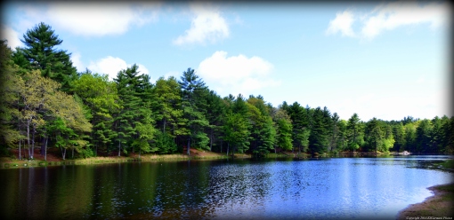
Peck Pond

Peck Pond

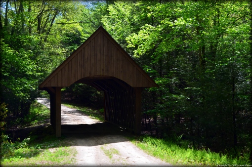
Covered Bridge

Covered Bridge

Great Woods – Mansfield


Many locals know Great Woods (or the many names it has had since opening) as a concert venue. What many don’t know is that there is in fact an area of dense great woods to the west and north of the venue. Today, finally after two failed previous attempts, I made my way into Great Woods. I was also joined by a rookie hiker for this walk. We started the hike from a parking area at the sharp bend in Oak Street. We first made our way down the narrow orange trail through a field and then along the edge of the woods. The trail then turned into the woods as it widened a bit. The woods were covered in areas with dense green ferns. The trails here are clear and well maintained. The are a little root bound and muddy in places but easy to navigate nonetheless. We followed the orange trail to its end then turned left onto the red trail. We then turned right onto the green trail passing a sign calling off the Codding Farm site. We followed the green trail to its end passing several lady slippers that are in bloom. I had seen some earlier in the week in Rehoboth as well. The green trail ends at the Massachusetts Bay Transit Authority’s railroad tracks. Do not cross the tracks. We happened to come out to the railroad tracks just as the Acela train was coming by. I’m not sure how fast it was actually going on this stretch of tracks between Providence and Boston, but it is known to travel at speeds of 150 miles per hour. It certainly seemed that it was going at least 100 miles per hour or faster when it went by. After being blown away (almost literally) by the train, we turned around and made our way back into nature retracing our steps back down the green trail. At the red trail we turned right and followed that back to the parking lot. We did not come across any wildlife other than birds here and the sounds of frogs. We also saw some stone walls and old abandoned farming equipment.


Trail map can be found at: Great Woods.

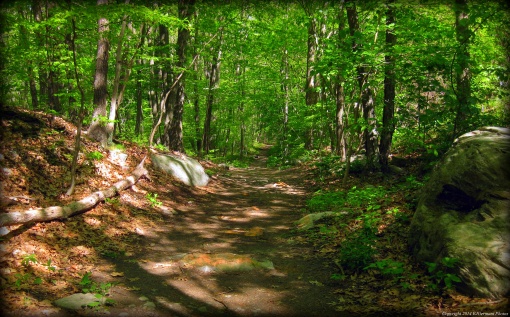
Along The Red Trail

Along The Red Trail

Rehoboth State Forest – Rehoboth


This hike made for a few milestones. Firstly, without realizing it I hiked in four states in three days. On Saturday I drove to Franconia Notch in New Hampshire, on Sunday I did a series of hikes in Rhode Island and Connecticut, and this evening I hiked here in Massachusetts. Secondarily, this hike put me over the 300 mile mark since I started this blog. I was joined by a co-worker (who is one of the organizers of The Rhode Island Hiking Club). We started this hike following the main path pass the gate into the forest. We passed several narrow paths to the left and one trail to the right (we would return from that trail) following the main trail to its end. There we saw the first of the blue blazes to the right. The trail to the left ended abruptly at a “No Trespassing” sign. We went right following the blue blazes through the woods and some areas of mud. The trail eventually looped back to the main trail. We then did some exploring of the side trails we saw on the way in. There was evidence of a “Tough Mudder” event here. We also came across some lady slippers that were in bloom. It is illegal to remove these flowers. After we explored just about all of the trails we concluded the hike.


Trail map can be found at: Rehoboth State Forest.

Stone Wall At Rehoboth State Forest

Stone Wall At Rehoboth State Forest


Old Furnace – Killingly

  • Old Furnace State Park
  • South Frontage Road, Killingly, CT
  • Trailhead: 41°47’17.65″N, 71°51’56.44″W
  • Last Time Hiked: May 18, 2014
  • Approximate distance hiked: 2.5 miles
  • Difficult with strenuous elevation, climbing and rocky footing.
 
EXERCISE EXTREME CAUTION NEARS THE CLIFFS.


After three shorter morning hikes in Rhode Island I stopped on the way to Killingly to pick up a family member for the fourth hike of the day. He had suggested this hike to me a few weeks before I broke my ankle last summer. Without any doubt whatsoever this hike has been the most challenging since the injury. The sense of accomplishment was overwhelming and the views were breathtaking. We started the hike from the parking area at the north end of the park following the blue blazed trail crossing a stream before veering onto the yellow trail. We followed the yellow trail over a foot bridge and through some muddy areas before approaching a small dam at the pond. While at the pond we noticed a massive rock overlook up on the hill to our right. Like kids again, we looked at each other at said “let’s do it”. We followed the stone wall dam of the pond until we got to the bottom of the hill. This trail was not blazed. Up to this point the hike was relatively easy, but that was about to change. We began our ascent up the hill. In some sections the grade was 75 to 100 percent (see chart below). After stopping for a bit for some water and a breather we made the final push up (in my opinion the wrongly named) hill. Half Hill is 540 feet above sea level and 200 feet above the pond below. The views from above are truly impressive, overlooking Killingly and Foster, Rhode Island. We also ran into some rock climbers at one of the overlooks. I will stick to hiking, thank you very much. There are also some quite impressive chasms here. We then continued to follow the trail downhill where it forks. We took the trail to the left following downhill (the trail to the right was blazed blue). It would eventually turn to the left and come out to a parking lot. We then crossed the parking lot picking up a trail that would follow the pond to the right and the cliffs above to the left. This narrow trail at times became more of scurrying over rocks and boulder. The trail ended at the trail we came in on just at the base of the hill. We turned right following first the stone wall dam and continued retracing our steps back to the car. We came across several hikers here and I did not see any wildlife here other than birds.


Trail map and additional information can be found at: Old Furnace.

One Of The Overlooks

One Of The Overlooks

The View From The Overlook

The View From The Overlook

Chart Showing Grades (from Wikipedia)

Chart Showing Grades (from Wikipedia)

Westconnaug Meadows – Scituate

  • Westconnaug Meadows
  • George Washington Highway, Scituate, RI
  • Trailhead: 41°46’0.18″N, 71°40’18.46″W
  • First Time Hiked: May 18, 2014
  • Last Time Hiked: January 1, 2020
  • Approximate distance hiked: 1.3 miles
  • Easy with slight elevation.
 

Just outside of the village of Clayville is Westconnaug Meadows. This property, owned by the Scituate Land Trust, offers a short trail that is just over a mile long. It is a good hike for beginners and children. The trail head is at the parking area for the ball fields on George Washington Highway. The trail enters the woods by the stone wall. There is a sign here at the trailhead. The trail first crosses two small boardwalks before turning right into the thick of the woods and slightly uphill. This first section can tend to be a little muddy in wet conditions. Along the way there are several signs describing the types of trees such as the black oaks, red oaks, white pines and sassafras, to name a few. The trail then comes to a fork. Stay to the left here and follow the trail downhill a bit. The trail soon starts bearing right and slightly uphill. This part of the trail is a loop. You will soon see yellow blazes on trees to your left. This marks the property of the Scituate Reservoir – you are not allowed to cross onto that property. There is small overlook along this stretch that gives you a view of the property to the west. If you look closely you will see a small stream below. The trail slowly takes a series of small right turns passing some boulders left behind from the days of glaciers. Soon the trail returns to the fork. Here, you turn left retracing your steps back to the parking area. The entire trail is marked with brown plastic trail markers and is very easy to navigate. The property is well-preserved and well-maintained by both the Land Trust and the Conservation Commission. I was tremendously surprised by this hike – I may chalk this one up as one of the most peaceful, serene and quiet hikes I’ve enjoyed yet. About midway into the hike, I found myself in complete silence – other than the sounds of the chirping birds and the breeze blowing through the various types of trees. Without any doubt, I would consider this one of Rhode Island’s best kept secrets.

I did not find a trail map on-line for this site.

At Westconnaug Meadows

At Westconnaug Meadows

This trail was featured in Rhode Island Monthly Magazine – October 2014

This trail was featured in RI Local Magazine – April 2015

Johnston Town Forest – Johnston

  • Johnston Town Forest – Pascone Acquisition
  • Memorial Avenue, Johnston, RI
  • Trailhead: 41°49’40.69″N, 71°30’28.84″W
  • Last Time Hiked: May 18, 2014
  • Approximate distance hiked: 1.3 miles
  • Easy with slight elevation.


I did not find much information on-line (almost nothing at all except minutes from town meetings) for the Johnston Town Forest. It is wedged between Memorial Avenue and Interstate 295 and features two ponds as well as the Pocasset River. The trails have been maintained and blazed by local boy scouts. I decided to follow the main orange blazed trail for a bit following the northeast edge of the first pond. When I came to a path blazed yellow on the right I opted to follow it. This path went around the second pond meandering up and down small hills and going by some areas of ledge. There were other trails that went off to the right along this stretch but I opted to keep the pond to my left making the full loop and returning to the orange trail. From here I retraced my steps back to the trailhead.


I did not find a trail map on-line for this site.

A Trail In The Johnston Town Forest

A Trail In The Johnston Town Forest

Johnston Memorial Park – Johnston

There are three short blazed walks here at Johnston War Memorial Park varying from a third of a mile to a full mile. I opted to follow the park walk (marked by yellow footsteps on the asphalt walk). Starting at a parking area just off Memorial Avenue I followed the path counter clockwise around Pocasset Pond. The pond itself is a haven for ducks and geese. I saw several lily pads here as well. After the small bridge over the waterfall the yellow footsteps move away the pond and into the area of the park with several monuments. There is a M60 A3 Main Battle Tank as well as a 105 MM Howitzer located here. The walk then continues by a baseball field and a pavilion before returning to the pond. At the pond I came across a few Canadian Geese and several gosling. They were for the most part very unbothered by people. I finished the walk by returning to the parking area.

I did not find a trail map on-line for this site.

Pocasset Pond

Pocasset Pond

Willett Pond – East Providence

Willett Pond is in the Riverside section of East Providence. It is a nice little spot wedged in an suburban area. In the 1870’s a dam was built at the Mosskettuash Brook to create Willett Pond. Its original purpose was to harvest ice for the growing resorts in Riverside. In later years the resorts closed and residential neighborhoods were built in the area. The ice harvesting ceased and the pond was used primarily for recreation. Today the pond is stocked with trout in early spring and is used for fishing in the spring and summer. There is also a boat launch here for kayaks and canoes. A short half mile trail loops the lower half of the pond. The trail, blazed orange, begins at a parking area between a small shopping strip and the pond itself. The trail then follows the edge of the pond behind a residential area before turning to the left and crossing the water on a small wooden bridge. The trail then curves to left again following the shore of the pond. The trail at some points comes out into grass areas of what seems to be backyards of the abutting properties and then back into the wooded areas again. The trail then comes out to the grass area along Willett Avenue. From here you can walk pass the small spillway and back to the parking area. Swans are common sight and tend to nest here. Please do not disturb them. Otters have also been seen here in the winter months.

Trail map can be found at: Willett Pond.

Wildlife At Willett Pond

Wildlife At Willett Pond

Elm Street Acres – Somerset

  • Elm Street Acres
  • Elm Street, Somerset, MA
  • Trailhead: 41°47’10.09″N, 71° 8’48.13″W
  • Last Time Hiked: May 12, 2014
  • Approximate distance hiked: 1.2 miles
  • Fairly easy with some elevation and difficult stream crossings.


When I researched the Somerset area for hikes I did not come across much except for a You Tube link. Someone had posted a few videos of hikes they had took in various small parks and conservation areas. So without any need to say this was an exploratory hike. I also hadn’t planned on hiking today until a friend called me and asked to go for a short hike. We started from a small parking area and headed into the woods. We opted to go left first and followed the trail, occasionally seeing red blazes, for a while. We passed a few trails to the left that led up a hill. I was using GPS and at one point it seemed that we were leaving the conservation property. We turned around and started up the hill to an overlook. We then followed a trail down the other side of the hill until we came to a stream. The crossing proved to be a little challenging. After crossing the stream the trail then started looping back and we came to a second stream crossing. This crossing proved to be very challenging. We did manage to stay dry, only mostly due to waterproof boots. From this point we meandered a bit and found a second overlook before using the GPS to find our way out. For the most part this was a loop trail with some other options. I will be back in the Somerset area in the future to explore some of the other sites.


I did not find a trail map on-line for this site.

Stone Wall Along The Trail

Stone Wall Along The Trail

Cascade Brook – Smithfield

  • Ken Weber Conservation Area at Cascade Brook
  • Mapleville Road, Smithfield, RI
  • Trailhead: 41°52’47.54″N, 71°34’11.54″W
  • Last Time Hiked: May 11, 2014
  • Approximate distance hiked: 1.0 mile
  • Fairly easy with some significant elevation and climbing.


Cascade Brook made for a nice short and scenic Sunday afternoon stroll. Starting from the dead end of Mapleville Road I made my way into the conservation area following the blue blazed trail. It is a loop trail that is just about a mile long and climbs up and down small hills and ledges. The main feature of this hike is a seasonal waterfall. It is suggested to hike here in the spring when the waterfall is most likely to be active. There are also other trails here. I followed one, short that it was, into a nearby apple orchard. The conservation area is dedicated to Ken Weber who was a Smithfield resident and the author of several hiking books that I have used in research.


Trail map can be found at: Cascade Brook.

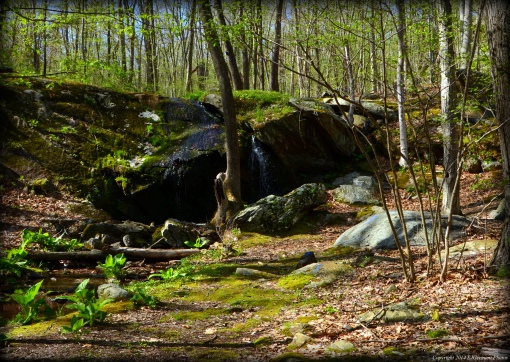
Seasonal Waterfall

Seasonal Waterfall