Posts Tagged ‘ Burlingame Management Area ’

Sammy C North – Charlestown

  • Sammy C North
  • Shumankanuc Hill Road, Charlestown, RI
  • Trailhead:  41°24’33.33″N, 71°41’23.60″W
  • Last Time Hiked: November 20, 2020
  • Approximate distance hiked: 3.7 miles
  • Moderate, can be difficult in areas.


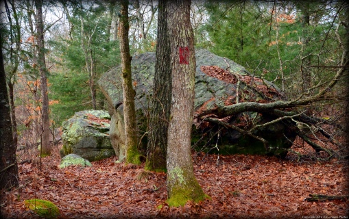
Six days prior I had done the Sammy C South loop. I had realized then that there was more to the Sammy C to be done. Today, with a map in hand that shows all of the trails, I headed out to explore the rest as well as the Secret Trail. Starting from the small parking area (big enough for two cars) along Shumankanuc Hill Road, follow the unmarked trail into the Management Area. Hunting is allowed here, be sure to wear orange! This trail is quite level and is flanked by small ledges giving you a preview of what lies ahead. You will reach a trail intersection. Make note of the area, you will need to leave the property here as well. Turn right here and follow the white blazes. You are now on the Sammy C Trail. It winds up and down and up and down several times over small hills and along ledges. There are some great stone walls along the way, one with an old gate opening marked by granite posts. Possibly an old farm? After climbing over several more small hills and weaving through their valleys the trail levels out a bit passing closely to Buckeye Brook Road before veering off to the left and slightly downhill. The Sammy C soon ends at the double white blazes. Here turn left onto the yellow blazed Vin Gormley Trail and follow it a bit crossing a stream first before coming to a trail intersection. At this intersection the yellow blazes turn to the right. Continue straight ahead onto an unmarked trail. This trail is fairly level. Start looking for a white/red double blaze on the left. This is the Secret Trail and it will give you a workout. Also be sure to follow the blazes as this trail turns often and suddenly in many locations as it traverses up and over several rock formations. Following the Secret Trail you will first encounter an upward climb followed by an area of trail that straddles a 20 foot plus ledge. There is no “guardrail” here so do use caution. Another highlight along this stretch is a towering sycamore tree in the valley below. The trail then comes out to a wider cart path. Turn right here, still following the blazes, and start looking for your next turn on the left. The next highlight is a large outcrop, the trail is to the right here slightly downhill. The trail now weaves through groves of mountain laurel and rock formations as it zigzags to the east. There is an area that can be a bit confusing ahead so be sure to follow the blazes. The trail descends in to a valley and quickly climbs up a rock outcrop. At the top the trail turns to the left and does an almost complete circle to the right before climbing up another rock. The blaze is beyond that rock. From here the trail descends into another valley, crosses a stream, and then climbs back up yet another significant hill before ending at the School House Pond Trail. Turning left here, follow the blue blazed trail as it descends down hill to the next trail intersection. Turn left, back onto the Sammy C Trail, blazed white, and follow it back to the trail you entered the Management Area on. Along the way you will come across a boardwalk, more mountain laurel, and another large outcrop. Note the indentation in the outcrop. It looks as if a hiker left their footprint here along their journey. When you reach the next intersection. Turn right. This will lead you back to the parking area.


Map can be found at: Sammy C North.

TWRI-SammieN07

The Sammy C Following an Outcrop Along A Stone Wall

Sammy C South – Charlestown


I went into this hike blindly assuming that the Sammy C Trail only ran from the Vin Gormley to the School House Pond Trail. I would learn later that was not true. I did have a plan and a route in mind (which I kept true to for this hike). This hikes starts along Kings Factory Road where the Vin Gormley skirts back into the woods just north of Quail Lane. There is street parking here for a handful of cars. There is also a “Mile 5.5” sign here. Following the yellow blazed Vin Gormley Trail, you will descend slightly until you get to Cool Spring Road. Here take a right and then an immediate left following the yellow blazes. Just after the road look for the sign for the Sammy C Trail on the right. The Sammy C Trail is used quite a bit by cyclists as it offers quite a bit of ups and downs. Following the white blazes the trail winds through glacial outcrops, thick ground covering, and a stream crossing before coming to the “NEMBA” bridge, a mountain bike obstacle. You will not miss it!! (NEMBA = New England Mountain Bike Association). The trail then zigzags up and over small ledges for a bit passing stone walls, a couple more boardwalks, and large areas of outcrops, before finally coming to the School House Pond Trail. This is where I thought the trail ended… but! The sign here indicated that the Sammy C continues north. With no information in hand I kept to the plan and decided the rest of the Sammy C would be done later after some research. So here I turned left and followed the blue blazed School House Pond Trail (toward the Vin Gormley) as it steadily, but gently climbed up hill for quite a distance. There is a nice grove of mountain laurel along this stretch. Soon I came to an intersection. To the right was the Secret Trail. Well that wasn’t on my map either. The next hike could prove to be interesting! Looking around I noticed the blue blazes uphill to the left. The trail now followed the edge of a ledge above a valley below to the right. The trail soon turns downhill, through the valley and back up the other side. The trail then continues passing a stone wall and crossing a stream before ending at the Vin Gormley Trail. Taking a left here, follow the yellow blazes. This trail will lead you back to the parking area, first passing through some interesting rock formations, and the by Cool Spring Road once again before ending at Kings Factory Road. Hunting is allowed here, be sure to wear orange!


Map can be found at: Sammy C South.

TWRI-SammieS03

NEMBA Bridge

TWRI-SammieS07

Along The Sammy C Trail

North Camp – Charlestown


Burlingame is most likely known for its campground off of Route 1. What most people do not know is that there is an abandoned camp on the north end of Watchaug Pond. Starting from a small parking area by a gate (two tenths of a mile east of the main parking area) on Buckeye Brook Road, you first follow an old dirt road southerly into the management area. You will soon come to an intersection. The trail that crosses is the 8 mile Vin Gormley Trail. For this hike continue straight ahead passing a couple small ledges and stone walls. The trail the splits at a fork, stay to the right for the first views of the former camps ruins. On the left you will see an old structure that is decaying rapidly. Continuing ahead you will soon come to another trail intersection. You will want to turn left here, but first follow the trail straight ahead for your first glimpse of Watchaug Pond. Returning to the last intersection, (trail now on your right), turn and follow the trail to the next intersection. The trail to the left would lead you back to the trail you came in on, the trail to the right will lead you to some more ruins if you care to check them out, the trail ahead is what you want to continue on. The trail slowly veers to the right and out to a small beach that overlooks the pond. At the opposite end of the beach the trail continues. Stay to the right, the trail winds to the left through an area that looks as if it were once campsites. The trail now bends to the north passing another building on the right before narrowing quite substantially and following a stone wall to the right. At the next trail intersection turn left onto the yellow blazed Vin Gormley Trail. In a few hundred feet you will come to the old dirt road you came in on. Turn right here and retrace you steps back to the parking area. Other than the Vin Gormley Trail, none of the trails on this hike are blazed.


Trail map can be found at: North Camp.

TWRI-NorthCamp

The Beach at North Camp

Vin Gormley Trail – Charlestown

  • Vin Gormley Trail – Burlingame Management Area
  • Kings Factory Road, Charlestown, RI
  • Trailhead: 41°23’26.49″N, 71°40’43.51″W
  • Last Time Hiked: May 24, 2015
  • Approximate distance hiked: 8.0 miles
  • Moderate due to length, some rocky areas.

The Vin Gormley Trail in Charlestown is an 8 mile loop that traverses through a diverse terrain. A member of the Trails Committee of the Appalachian Mountain Club, John Vincent Gormley is a local hiking legend. Mr. Gormley spent countless hours clearing and maintaining trails in both the Arcadia and Burlingame Management Areas. In the 1980’s he started maintaining the yellow trail loop around Watchaug Pond. In the early 1990’s, the State of Rhode Island named this trail in his honor. The trail technically starts at the Burlingame Campground, however parking is difficult, if at all, and there is a fee to get into the campground during camping season. There is, however, a small parking area along Kings Factory Road where you can start the trail. Choosing this point for the beginning eliminates a good portion of the road walking first. From here you head south along Kings Factory Road, then turn right onto the Prosser Trail (a paved road). Soon you turn right again into the Burlingame picnic area. Stay to the left when you approach the information board and follow Sanctuary Road. The road soon becomes a gravel road as it approaches the Audubon Society’s Kimball Wildlife Sanctuary. The Vin Gormley Trail then splits to the right off of the road and follows the south end of Watchaug Pond as it cuts across the Audubon property. There are several spur trails here to the right to catch a view of the pond. Continue to follow the yellow blazes and you will soon approach the campground. Stay to the right when you get to the playground and then follow the yellow blazes straight ahead of you through the campground. Soon you will approach and information kiosk about the history of the trail. At this point you have hiked 2.4 miles, the remainder of the hike (with the exception of a short 1/4 mile stretch) is on wooded trails. The trail meanders through the woods as it crawls over boardwalks and passes streams and stone walls. The Vin Gormley Trail is joined by the blue blazed North South Trail for several miles as well. Where the trail crosses the Peary Healy Brook there is a covered bridge followed by a long stretch of more boardwalks. Continue to follow the yellow blazes northward passing several areas of ferns. When the trail comes out to Buckeye Brook Road, continue to follow the yellow blazes. You will be following the road a short distance before jotting back into the woods on the right once again. The last stretch of the hike continues to follow the yellow blazes crossing the access road to the former Burlingame North Camp. Continuing through areas of ledges and outcrops the trail becomes rocky. We concluded the hike at our point of beginning. The trails here are well worn and defined, however there are several trails that spur and lead off of the Vin Gormley. Be sure to keep an eye for the trail blazes at the trail intersections.

Trail map can be found at: Vin Gormley Trail.

The Covered Bridge At The Vin Gormley Trail

The Covered Bridge At The Vin Gormley Trail

Kettle Pond – Charlestown

  • Kettle Pond – Ninigret National Wildlife Refuge
  • Bend Road, Charlestown, RI
  • Trailhead: 41°22’2.85″N, 71°41’10.68″W
  • Last Time Hiked: July 7, 2014
  • Approximate distance hiked: 2.6 miles
  • Easy with slight elevation.


Kettle Pond is the northern parcel of the Ninigret National Wildlife Refuge. It is also the parcel that is home to the Rhode Island headquarters of the National Wildlife Refuges. Inside the building there is information on the types of lands and animals found throughout the refuge. This property also has a handful of trails. This would be my second of three planned walks on this refuge. I started from the parking area near the headquarters building and followed the Watchaug Pond Trail to its end passing both the Burlingame Trail and Toupoysett Pond Trail. I continued further down a dirt road and then turned left. I followed this road for a few paces to the entrance of the bordering Audubon property. From here I retraced my steps back up the dirt road and along the Watchaug Pond Trail. I then turned right onto the Toupoysett Pond Trail passing through part of the Kimball Wildlife Refuge as the trail looped back to the Watchaug Pond Trail. I then turned right, and then right again onto the Burlingame Trail and followed it to the edge of the Burlingame State Park. From here I retraced my steps back to the Watchaug Pond Trail, turning right again, and going back to the parking area. On the opposite side of the building is the Ocean View Trail which leads out to an observation tower. From the tower you can see Ninigret Pond and the Atlantic Ocean. On a clear day you can also see Block Island. After sightseeing for a bit I returned to the parking area. This property borders both Kimball and Burlingame and several miles could easily be added to this hike.

Trail map can be found at: Kettle Pond.

A Trail At Kettle Pond

A Trail At Kettle Pond

Kimball – Charlestown

  • Kimball Wildlife Refuge
  • Sanctuary Road, Charlestown, RI
  • Trailhead: 41°22’23.06″N, 71°41’15.32″W
  • Last Time Hiked: March 15, 2014
  • Approximate distance hiked: 1.1 miles
  • Easy with some slight elevation.


I started this hike from the parking area by the nature center and started following the red trail. I was immediately met by a flurry of small birds including many sparrows and woodpeckers. I followed the red trail to its end as it wandered through areas of forest and boulders. I then turned left onto the orange trail passing a small pond. At the next intersection I turned left and followed the green trail. There were many trees down at the time of this hike and I had found some difficulty following the green trail but I did manage. I then turned left following the blue trail. This trail merged with the yellow blazed Vin Gormley Trail for a bit. There are a couple narrow trails that lead to the shore of Watchaug Pond and I took advantage of them for some photography. I then resumed following the blue/yellow trail until the blue broke off to the right. I continued following the blue trail through a memorial garden and then left back to the parking area.

Trail map can be found at: Kimball.

Along The Red Trail

Along The Red Trail

Two Rivers – Charlestown


This is a short hike on a dirt road in the extreme northern part of the Burlingame Management Area. It is an “in and out” hike mostly through a thick forested pine grove.  The trail begins from the parking area on Burdickville Road at a gate. At the end of the trail is where the Wood River ends flowing into the Pawcatuck River. There is a small and narrow path you can follow to the riverbank. From this vantage point you are standing in Charlestown, across the river to the right is Richmond, and across the river to the left is Hopkinton. These three towns give the region its nickname of Chariho. I came across several deer tracks in the snow here. Keep in mind this is a hunting area. Be sure to wear orange. There are also a set of trails that run along the power lines if you care to explore further.

Trail map can be found at: Two Rivers.

Towering Pines at Two Rivers

Towering Pines at Two Rivers

Shumunkanuc Hill – Charlestown

  • Shumunkanuc Hill – Burlingame Wildlife Management Area
  • Buckeye Brook Road, Charlestown, RI
  • Trailhead: 41°23’54.86″N, 71°42’5.40″W
  • Last Time Hiked: July 26, 2013
  • Approximate distance hiked: 4.5 miles
  • Easy with slight elevation.

This hike, known in Weekend Walks in Rhode Island as Burlingame North, is mostly on closed off access roads of the Burlingame Management Area which makes for a nice and easy walk. It starts at a parking area along Buckeye Brook Road. After passing the gate, I followed the heavily wooded road into the management area. This section, known as the Clawson Trail, is blazed blue and part of the North South Trail. A little ways into the hike there is an access road that veers off to the left. I had continued straight at this point. (I would return from the other road). After passing an old stone dam on the right there is another access road, known as the Burdick Trail, to the right. I had followed this a couple hundred feet to a clearing to view a small pond that is the source of the Buckeye Brook. I then returned to the Clawson Trail and resumed walking until I reached an intersection that had a sign for the North South going to the right. This is near the top of Shumunkanuc Hill. I went to the left here following a road that had stone walls on both sides until I reached a gated road on the right. I then followed the white blazed road to the right known as the River Loop. Trouncing through small areas of tall grass along the way I came to the canoe camping area along the Pawcatuck River. After lingering for a bit I continued to follow the white blazes as the road turned into a footpath. Keep an eye out for the blazes in the next section as the trail becomes very narrow and dense with growth. (At the time of this hike there is an area with a tree down and the trail is barely passable. After making your way around the tree, make sure you locate the next blaze before wandering too far.) This trail is abundant with ferns as it skirts a swampy area. The trail is also muddy in some spots. At the end of this trail I turned right onto another access road called the Mill Trail. I followed this trail straight (ignore the road to the right up ahead) until it came back out to the blue blazed Clawson Trail. Along the way I accidently came across a geocache location. I then retraced my steps back to the car.

Trail map can be found at: Shumunkanuc Hill

Clawson Trail

Clawson Trail

Ferns And Stone Walls

Ferns And Stone Walls

Pawcatuck River

Pawcatuck River