- Weetamoo Woods/Pardon Gray Preserve
- East Road, Tiverton, RI
- Trailhead: 41°34’19.94″N, 71°10’37.90″W
- Last Time Hiked: November 28, 2014
- Approximate distance hiked: 5.6 miles
- Moderate with optional areas of climbing that can be difficult.
The first true signs of winter made for a very cold but picturesque hike at Weetamoo Woods. The woods are named for the sachem of the Pocasset Wampanoags. I was joined by a group for this hike, some being locals, who knew the property fairly well. We started from the parking area at the southern end of the property along East Road. We headed north into the property on an old section of Eight Rod Road. Soon we came to an informational board where trail maps can be found. From this point we continued straight following the yellow trail. The old road passed open fields to the right and an old stone wall (the first of several on the property) on the left before crossing Borden Brook. The brook at the time of this hike was fast flowing as it fell over a small waterfall by the slab bridge. We followed the yellow trail, passing a cellar hole on the left, until we came upon the red trail. Take your time looking for some of the blazes. Although most of the property is well marked we did have some difficulty at some of the intersections location the markers. We then followed the red blazed trail until we came to an old sawmill site. The stream here runs through an old channel and then under a beautifully constructed stone arch bridge. To appreciate the craftsmanship of the structure take a quick detour off the trail to the shore of the stream. After looking around at the mill remains we then followed the blue blazed trail (just before the mill on the left) uphill. The trail meanders up the hill a bit before coming to an area on the right that has been clearly traversed by many. This area is the foothill of High Rock. We followed the un-blazed trail, led by our locals, up to the peak of High Rock. Some of the trail requires some climbing and can be difficult. We had a light snowfall in the morning and the leaves were quite wet adding to the difficulty. We took our time and the climb was well worth it. The view from above overlooks the property well above the tree line. After enjoying the view for a little while we retraced our steps back to the mill site. From there we continued along the red trail (to the left) before turning left onto the green trail. This trail meanders through the heart of the woods passing through an area of mountain laurel. The light dusting of snow contrasted quite nicely with the crisp green leaves. The trail soon crossed the brook once again via a boardwalk. We then reached the intersection of the yellow trail. We went straight onto the yellow trail (left we be our exit) until we reached the second white blazed trail. Both of the white blazed trails are marked with signage. The first, being the South Trail, would lead you to the town farm. We opted to continue to the Cemetery Trail. After turning left onto the Cemetery Trail the trail split again. The Cemetery Trail continues to the left and is blazed white with a red square. The Ridge Trail on the right would be our return route. Following the Cemetery Trail we came across some boulders in the woods, more stone walls, and a vernal pool before coming to an open field. The field is part of the Pardon Gray Preserve and is actively farmed. The preserve is named after a Revolutionary War Colonel. The Cemetery Trail continues straight uphill towards a cluster of tall trees. On each side of the trail is areas of grass being grazed by cows. The areas are fenced off with electric fences. Needless to say, it is advisable not to come in contact with the fences. At the top of the hill under the cluster of trees is the Gray family cemetery bordered by a stone wall. Most of the graves here are from the early 1800’s including Pardon Gray himself. We then retraced our steps through the field back to the tree line. Here we turned left and followed the tree line. The cows in the field on the left seemed very interested in our presence even offering some photo opportunities. The trail soon turned left and we then turned right onto a narrow trail that led us through the woods to Lafayette Road. We turned right onto the paved road and followed uphill to the gate. Here we turned right, through a small parking area, and onto the Ridge Trail. The trail, also blazed white with a red square, passes through areas of holly trees and shrubs before intersecting with the Cemetery Trail once again. Here we turned left and then right onto the yellow trail once again. We then followed the yellow trail to its end back at the parking area. On the way out at the end of the hike we were greeted by a very friendly pony on the farm property on the right.
Trail map can be found at: Weetamoo Woods/Pardon Gray.

The Trail To High Rock

Boardwalk On The Green Trail
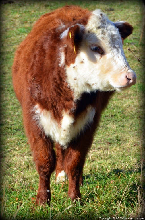
Cow At Pardon Gray Preserve


