Spencer Rock – Coventry
- Spencer Rock
- Lewis Farm Road, Coventry, RI
- Trailhead: 41°41’24.97″N, 71°45’41.28″W
- Last Time Hiked: May 12, 2015
- Approximate distance hiked: 2.0 miles
- Easy with some slight elevation.
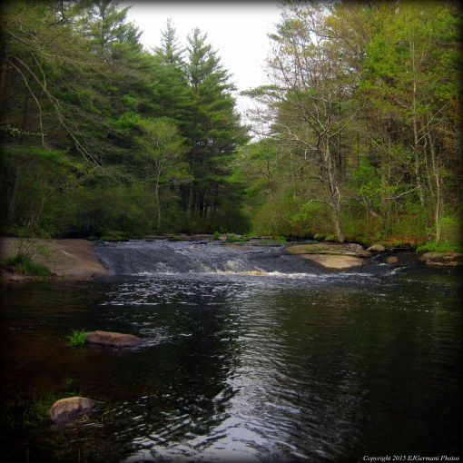
In western Coventry the Moosup River cascades over a rock formation creating a waterfall. This large boulder the width of the river is known as Spencer Rock. The beautiful natural feature is accessible from various locations throughout the Nicholas Farm Management Area, but for this hike, I choose the most direct and easiest route that follows the blue blazes of the North South trail. I started the hike from Lewis Farm Road where the Trestle Trail crosses and started hiking westward. The Trestle Trail is an old railroad bed that once was used as part of the Providence, Hartford & Fishkill Railroad. The trail to the east is under development and is becoming a bike path. This part of the trail will one day connect to the Coventry Greenway and the Washington Secondary Bike Path. But for now it remains a dirt path that was once a railroad. Within in a couple hundred feet I was crossing a narrow trestle bridge. The trestle is now paved and has chain link fence on each side for safety. It sits high above the Moosup River. From here I observed a squawking crow among the tree tops. Just on the other side of the bridge in the middle of the trail you will find a square chunk of granite with a drill hole in it. This is a granite bound used by surveyors to mark property lines and corners. With that being said, there are many side trails along this stretch, however the trails to the south lead off the management property. I continued straight along the old railroad bed that is high above the surrounding terrain. Following the blue blazes, I soon turned right onto a trail the is surrounded by mostly pine trees with an occasional oak tree and some mountain laurel. The birds were very active along this stretch. I saw several wrens here and in the distance I could here frogs. I then came upon an small grass filled field that seemed to be a haven for dragonflies. The trail bends slightly to the right, back through the trees, and down a small rocky section before coming to a dirt road. Here, look for a white pole to the right with blue blazes on it. Beyond the pole is a narrow path that leads up and over a small hill to another dirt road. I then continue straight along the road a few steps through an open area to the river where Spencer Rock is. The rock is a large boulder that spans across the river and creates a small waterfall and the flow is very dependent on weather. I then spent some time lingering and taking in the beauty of this location for a while before retracing my steps back to the starting point. This entire hike follows the blue blazes of the North South Trail and the area is open to hunting. Be sure to wear orange during hunting season.
Trail map can be found at: Spencer Rock.

Visited this spot today and thought it was gorgeous. Very cool find. At the moment it’s much easier to do this from route 14 at the Nicholas Farm entrance since the bridge is out while they complete the Bike Path.