Posts Tagged ‘ Bird Watching ’

Harbour Island – Narragansett

The out and back blue blazed “Main Trail” runs from Brush Hill Road to Beach Plum Road. Along the way you will pass a vernal pool and climb up and over a rather significant hill. At the top of the hill you will find a swing and also sweeping views of Long Cove. On the way back be sure to check out the two “Scenic Side Trails”, both blazed white. They offer more views of Long Cove. The entire hike in total is just under three quarters of a mile.

Trail map can be found at: Harbour Island

TWRI-3Days01

The “Welcoming” Tree near the Brush Hill Entrance

Crooked Brook – Narragansett

This three mile out and back trail, recently marked with signs by the Narragansett Land Conservancy Trust, winds through the thick woods that surround Crooked Brook. Parking is available at the Narragansett Pier Middle School and the trail head is across the street. The first half of this hike traverses in a southerly direction between South Pier Road and Kinney Avenue under a canopy of tall trees while passing stone walls. The trail is blazed in a light green. The blue blazed Westmoreland Trail intersects about halfway through the first section. Just before the end of this first section you will come upon a long abandoned automobile. At Kinney Avenue turn left and follow the paved road a few feet to the trail head on the other side of the road. The remainder of the trail is a long straight section that seems to be an old cart path. You will cross Crooked Brook before coming to the granite fence post and the Kendal Green Stone. At the end of the trail turn left to check out the Historical Cemetery. This so called cemetery is one of the more interesting ones I have stumbled upon. There are eight pillars in a circular pattern surrounding a center stone. Records indicate that no one is actually buried here which brings into question its origins. You are now a mile and a half from the parking area. From here retrace your steps back.

Trail map can be found at: Crooked Brook

TWRI-Crooked01

Wide Path and Tall Trees

Pemmerl Town Trails – Rehoboth

  • Pemmerl Town Trails
  • Danforth Street, Rehoboth, MA
  • Trailhead:  41°51’28.02″N, 71°15’47.04″W
  • Last Time Hiked: October 21, 2022
  • Approximate distance hiked: 3.7 miles
  • Moderate with some elevation.

A recently developed parking area and a small handmade sign reading “Pemmerl Town Trails” is what I stumbled upon while doing some country road driving. What a great find!! The property is quite large and has a small network of trails at the southern end and a long meandering trail that reaches into the northern end and beyond. At the time of this hike the trails we marked with some occasional flagging indicating to me that there may be more improvements to come. Each intersection was well marked with homemade signs. I did stumble upon a map of the property artistically portrayed on one of the homemade signs. I explored the yellow “Cliff Walk Trail” with its wonderful ledges and outcrops, the high point of Counsel Rock, the orange “Winter View Trail” where in spots you have to get on your hands and knees to crawl and climb to reach the “LedgEdge”, and the green “Main Trail” which winds through the property to Perryville Pond. The blue “West Palmer River Trail” crosses private property, however there is a sign that seems to welcome visitors to use it. This is a beautiful trail that winds through areas of boulders, into low laying marsh, before coming to the banks of the river. At the pond there is a dam and waterfall. Be sure to use your GPS here as the trails are only marked at the intersections. And do respect private properties as there are unmarked trails that lead off the property.

TWRI-Pemmerl03

West Palmer River

TWRI_PemMap

Map of Pemmerl Town Trails

Osamequin Farm – Seekonk

At the headwaters of the Runnins River lies the sprawling Osamequin Farm. Known for its farm stand, the operational farm offers trails that are (currently) only open to the public during special events. A visit during a tree identification hike brought a small group for a mile long stroll along just a portion of the farms woodland trails. Along with stone walls, open fields, small ponds and the river, the property is graced with sugar maples, red maples, red oaks, sweet birches, white pines, junipers, spruce, and blooming witch hazel.

TWRI-OsaFarm06

A Farm Road in Fall

Ash Swamp – Cumberland

  • Ash Swamp
  • Nate Whipple Highway, Cumberland, RI
  • Trailhead:  41°58’57.94″N, 71°25’32.16″W
  • Last Time Hiked: September 4, 2022
  • Approximate distance hiked: 2.4 miles
  • Moderate due to lack of blazes and mapping, Some Elevation.

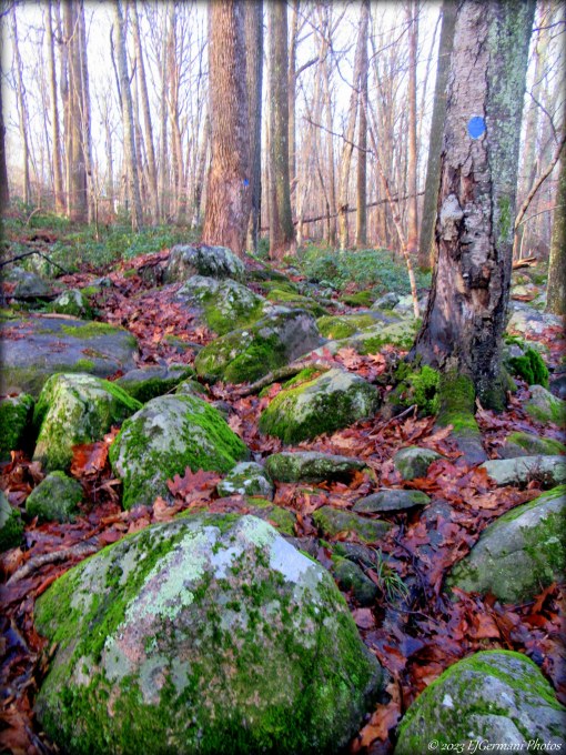
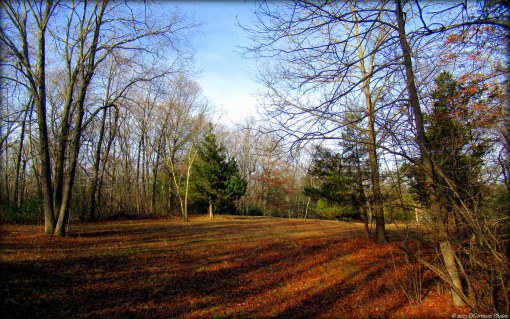
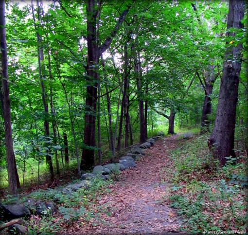
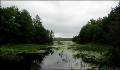
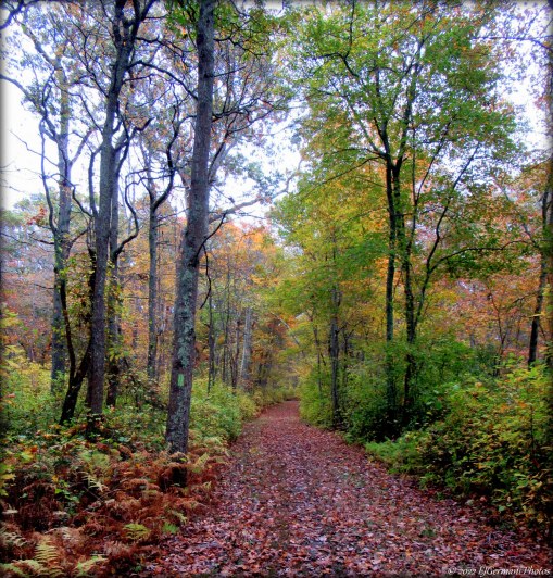
In the thickly wooded area behind the North Cumberland Middle School are a series of trails that meander across lesser known town owned land. Some of these trails are used by the schools cross country team and the remainder reach to Tower Hill Road. For this hike, I ventured into the woods with a map from “OpenStreetMaps” with the intention of finding and completing the two loops in the middle of the property. The first challenge was getting to the trail head. Passing through the main parking area for the school, drive behind the school to a smaller parking area at the back of the school. There is enough room for 2 or 3 cars here. From here follow the tree line around the bend and you will encounter a sign for the schools cross country program. This the trailhead! After entering the woods stay to the left. The trail to the right will lead you to Schofield Farm. In a little bit you will come to a four way intersection with some park benches. Turn right here. The trail winds northerly toward the first of the two loops. There will be a trail to the left just before a stream. Ignore it and continue ahead crossing the stream. Soon on the left you will get a glimpse of a boulder strewn landscape. At the next intersection stay to the right and you will cross a stream. A short distance ahead a trail comes in from the right. Ignore and stay on the main trail that veers to the left and starts a climb uphill. At the top of the hill the trail splits. Stay to the left and pass through the stone wall. The trail starts to turn to the left before straightening out. At the next split, stay to the left again. You will pass another stone wall before coming to the next trail intersection. Stay to the right here and continue ahead about sixty feet or so and there will be another intersection. Continue straight here and ahead to the next trail intersection. Ahead the trail is slightly overgrown. The main trail turns abruptly to the left. Follow the main trail as it starts a climb uphill. The trail turns to the right and levels out a bit, then turns left again and again uphill. There will be a trail to the left, ignore it and continue the climb uphill. At the top of the hill will be the next intersection. Turn left here and in about twenty feet or so will be another intersection, turn left once again. There will be a trail on the right, ignore it and continue ahead. You will now start a long descent downhill. Next, a trail comes in from the left, stay to the right and follow the main trail. And yet another trail to the right to ignore. Continue to follow the main trail downhill. At the end of the trail at the bottom of the hill turn right. Follow this trail about sixty feet to the next intersection. Turn right here and follow the main trail slightly uphill. Again a trail comes in from the right, and again ignore it. Near the top of the hill and on the left there is a narrow trail that leads to a footbridge. Take a moment to check this out. There is a babbling brook that cascades over the rocks here. Return to the main trail, it will turn slightly to the left and cross a stream. Shortly after the stream there will be another trail intersection. Stay to the left here. The trail descends downhill passing boulders and outcrops before ending at the next trail intersection. Turn right here and continue ahead to the four way intersection with the park benches. At the intersection turn left and follow the trail back to the trail head. During this hike, we encountered some chipmunks, squirrels, and a lone deer. A few suggestions and notes about this hike. Use GPS! You could easily get lost here and you will likely do some backtracking if you take a wrong turn. The map that I had used only showed the main trails. There are many other trails here that are not shown on the map. Some of the trails were blazed at intersections. These blazes are for the cross country team and are not typical “hiking blazes”. Also, it may be a good idea to tackle this hike on a weekend or holiday when the school is closed.

Trail map can be found at: Ash Swamp

TWRI-AshSwamp

Trail and Stone Wall at Ash Swamp

Tucker Woods Preserve – Charlestown

  • Tucker Woods Preserve
  • Alton Carolina Road, Charlestown, RI
  • Trailhead:  41°27’2.07″N, 71°40’16.74″W
  • Last Time Hiked: June 18, 2022
  • Approximate distance hiked: 1.2 miles
  • Fairly easy with slight elevation.

One of the newest trails opened to the public, Tucker Woods, once farmland, is now permanently protected by the Charlestown Conservation Commission. Starting from a new parking area along Alton Carolina Road follow the blue blazed trail into the property. The trail first passes by an open field with sporadic pitch pines before moving into the wooded area shaded by a canopy of oak. The trail widens to an old cart path. You will pass the yellow trail on the right. Continue ahead for now. The forest floor is covered in fern in some spots and there is a rather large hill on the left (future to top of hill is planned). You will pass the other end of the yellow trail, still continue ahead to the end of the blue trail. It splits and makes a loop. Continue ahead and uphill. The trail turns sharply to the right and follows a stone wall before turning again completing the loop. From here stay left and retrace your steps back to the yellow trail (now on your left). Turning onto the yellow trail, start looking for a spur on the left. This leads to a sitting area by a babbling brook with a small “waterfall”. The other side of the brook is part of the Carter Preserve. Making your way back to the yellow trail, turn left, and follow it to its end. The trail winds along the side of a hill for a bit before cutting its way back to the blue trail. At the blue trail turn left and retrace your steps back to the parking area. Trail map is at the kiosk and should be online in the future.

TWRI-Tucker05

Along The Yellow Trail

Remington Park – Burrillville

Wedged along a narrow parcel that was once a railway line, you will find a street hockey rink, tennis court, and a quarter mile bike path that leads to the shores of the Clear River. The path leads to a former rail crossing. This is a good spot to observe water fowl.

TWRI-HawRem07

Clear River

Winsor Park – Glocester

Working on nearly ten years of this project of trying to hike every public trail in Rhode Island will lead to some of these type of “hikes”. Yes, indeed, there is a trail here on this small recreation complex known for its soccer field, playground, and basketball court. Take a venture into the woods and you will find a peaceful quarter mile trail that loops a small pond. It is quite relaxing!

TWRI-Winsdor

Bridge Along The Trail.

Wunnashowatuckqut – North Smithfield/Blackstone

  • Wunnashowatuckqut
  • East Harkness Road, North Smithfield, RI
  • Trailhead:  42° 0’24.59″N, 71°33’37.07″W
  • Last Time Hiked: February 12, 2022
  • Approximate distance hiked: 2.6 miles
  • Moderate due to navigation, difficult at times with some hills.

Wunnashowatuckqut… What? It is Nipmuc for “where the river splits”. The Nipmuc were present on this land where the Blackstone River and Branch River meet just south of the Blackstone Gorge. And speaking of the gorge, you will get an entirely different perspective of the gorge on this hike along the lesser known trails along its western bank. For this hike, led by members of the North Smithfield Heritage Association, we followed trails through State owned properties. Being a warm day in February, the ground was frozen and quite icy in areas. The trails do become somewhat difficult in spots where you may be required to do a near climb on some of the uphill sections. The trails may also become quite muddy in spring weather. There is also no official blaze system or trail map, however, this loop can be completed following the orange marks provided by a local. With all that being said, I would not venture out onto this property without at least GPS or a general sense of direction. The other option is to follow the North Smithfield Heritage Association on Facebook and wait until they lead another hike on this property. Also be sure to wear orange as it is State property. Nonetheless, this hike is a good one, offering quite a bit to see. Starting from the bend in the road on East Harkness Road and Martha Road by utility pole 61, follow the paper street on East Harkness Road. It looks like a driveway (the one with the power lines), as it is in a sense. Soon you will see a house to the left. Continue straight and slightly uphill to continue following the paper street. It now becomes more of a cart path as it climbs slightly uphill into the former James Harkness Farm. Along this stretch you will be behind houses to the left. There will be an occasional spur trail to the left. Ignore these as they lead to private properties. Soon you will come to a trail intersection with a trail to the right. Ignore the turn and continue straight. The trail to the right is your return trail. Ahead you will notice the first of the orange marks. The trail crests the hill and starts its descent to the river. Along the way you will soon be flanked by a stone wall to the left. We saw at least a half dozen deer here. As the trail descends it is deeply rutted in areas. Be careful of your steps here. Near the bottom of the hill the trail narrows. Keep an eye out for the orange marks. You will cross another stone wall. This is the State Line and you are now entering Blackstone, Massachusetts and still descending down the hill. The narrow trail comes to a wider path. Veer slightly right here and follow the orange marks. The trail now levels and winds a bit. At the next intersection a trail to the left leads to private property and is posted. Stay right here and you will cross another stone wall. You will soon come to a large open area with a make shift fire pit near its middle. There are several spur trails leaving this open area. Stay just to the left of the pit and follow the main trail downhill. At the next split stay to the left. Still following the orange blazes you will come to another split. To the left is posted private property. Stay to the right here and the trail follows the shore of an inlet of the Blackstone River. This is a good spot to observe birds. Also there is evidence of beaver activity here. Continuing along this trail you will come to a wider trail ahead. Turn left here and in a few steps you will be on “The Other Side” on the famed Rolling Dam at Blackstone Gorge. The perspective here is quite interesting. For as many times as I have been to Blackstone Gorge, I had never step foot on the other side. This is a good spot for a break. The rest of the hike is uphill. Continue along the main trail for a few hundred feet. Turn left onto a narrower trail, once again following the orange marks. This trail climbs slightly and along the river passing mountain laurel and schist outcrops. As it winds slightly up and down hill you will get glimpses of the river and gorge below (maybe except when leaves are on the trees). You are now back in North Smithfield, Rhode Island. The trail then turns away from the river and increasingly climbs uphill. From here on out be sure to follow the orange marks and make sure your GPS is on. Soon a trail comes in from the right. Ignore it and continue straight ahead and uphill until you come to the next intersection. Take a breather! The worse of the uphill climb is now behind you. Stay right here and look for the orange mark on the tree. The trail bends slightly to the south and you will pass some boulders on the right. Slow down and pay attention here. You are looking for a right turn onto a very narrow trail that is almost non-existent. It is however marked with the orange marks (and at the time of this hike, flagging). Be sure to follow the orange marks as it is easy to drift off the trail. Here the trail climbs again slightly uphill. It soon widens a bit as it winds westward. This trail will eventually come to the trail you entered the property on. There you will turn left and retrace your steps back to the street.

TWRI-WSTQ06

Rolling Dam from the “Other Side”

TWRI-WSTQ07

The dam and rapids in the gorge as seen from the trail along the river.

TWRI-WSTQ11

Orange Marks… be sure to look for the next one!!

Lloyd Center – Dartmouth

  • Lloyd Center For The Environment
  • Potomska Road, Dartmouth, MA
  • Trailhead:  41°32’27.92″N, 70°58’41.36″W
  • Last Time Hiked: December 30, 2021
  • Approximate distance hiked: 1.3 miles
  • Fairly easy, some hills.

This privately owned nature preserve, sometimes called Lloyd Woods, is essentially an outdoor classroom complete with programs. The trails here are open to the public from dawn to dusk. For this hike, the last of the year, we made a short loop starting from the main parking area. We first followed the yellow blazed trail as it looped around to the trail. Here we turned right and followed it the blue blazed loop. Turning right here we would follow the blue blazes almost the rest of the way making a couple of detours to the waterfront via spur trails. The spurs offer sweeping views of the Slocum River and a beautiful pier. Along the way you will come upon an outdoor pavilion as well. After climbing up the hill we veered slight left through a raptor zone along the green trail then right onto the blue trail once again following to the access road. From here we followed the road back to the parking area. There are several more miles of trails to explore here.

Trail Map: Lloyd Center.

TWRI-Lloyd

Slocum River From The Pier