Hunts Mills – East Providence
- Hunt’s Mills
- Hunt’s Mills Road, East Providence, RI
- Trailhead: 41°49’41.78″N, 71°20’45.16″W
- First Hiked: June 8, 2014
- Last Time Hiked: January 9, 2022
- Approximate distance hiked: 0.75 miles
- Easy.
~~~
THE EAST PROVIDENCE HISTORICAL SOCIETY OFFERS GUIDED TOURS OF THE GROUNDS WHEN THE JOHN HUNT HOUSE IS OPEN TO THE PUBLIC. HOWEVER, DUE TO RISES IN COVID CASES AND STATE MANDATED SOCIAL DISTANCING ORDERS, THIS TOUR WILL BE SELF GUIDED. THE HIKE DESCRIBED HERE IS BEING USED AS A SELF GUIDED TOUR OF THE HUNTS MILLS GROUNDS.
~~~
For over 250 years Hunt’s Mills has served many purposes. It is probably one of the more historically significant sites in East Providences. In fact this property is home to the East Providence Historical Society. The historical society is at the John Hunt House which is one of the oldest houses in the city. The house was built in the mid 1700’s. This site also has been home to several mills over time dating back to the mid 1600’s including a sawmill and a grist mill. In the late 1800’s a local private company (Rumford Chemical Works) set up a water company here to supply their mills and factories with water. In the mid 1920’s the town would take over the water company, along with the Turner Reservoir, to supply the growing town with water until the town starting receiving its water from the Scituate Reservoir. At the turn of the century there was an amusement park here to help offset the cost of running the water company. And lastly, the fire department used this property as a training grounds for several years. The property also has the distinct feature of being in both the Blackstone Heritage Corridor and the Sowams Historic District.
- The hike starts near the small parking area by the gazebo just to the right of the Hunt House. The red blazed trail first leads down a set of wood stairs and boardwalk. These stairs and boardwalks were built by volunteers from the East Providence Conservation Commission with grants from the Narragansett Bay Commission over the course of three years. The stairs and boardwalk alleviate erosion in an area that was getting quite muddy.
- The trail then winds through an area known as the Terrace Garden. This area was part of the Master Plan for the Hunts Mills grounds. However, nature had other ideas. The flowers and shrubs that were planted along this stretch still bloom at different times of year among the trees and shrubs.
- The red blazed trail then turns right and zigzags through the woods before crossing an access road. This road was once a trolley line that ran through the property. Looking up the road, you will see the new Hunts Mills Dog Park. Looking down the road, you will see a stone pillar on the right side of the road. There is another on the opposite side of the road (out of sight). These pillars were the entrance to the Hunts Mills Amusement Park. At the turn of the last century there were four active amusement parks in East Providence. The first here at Hunts Mills, Boyden Heights, Vanity Fair, and most famously Crescent Park.
- The trail then crosses the road, continues straight in the woods to where the green blazed trail starts. For this hike continue following the red blazed trail meandering slightly downhill toward the Ten Mile River. At the bottom of the hill look for a spur trail on the left. It leads to a large sycamore tree. You can get inside the tree and look up to see daylight. The tree is believed to be the oldest on the property as it straddles an angle point on a stone wall. Trees like these were used in old deeds as property markers.
- Back out to the main trail you will catch your first glimpse of the Ten Mile River on the right. At the next trail blaze post, the red blazed trail turns to the left. Here on the right is a spot known as Sunset Rock. It tends to be a little overgrown in the summer months, but it offers a good view of the river the rest of the year. The Ten Mile River is in fact twenty two miles long. It is said that it gets its name from the first river crossing at the ten mile mark. The river starts in Plainville and winds through North Attleboro, Attleboro, Seekonk, Pawtucket, and finally East Providence before emptying into the Seekonk River at Omega Pond.
- Continuing following the red blazed trail will lead you to the next set of trail blaze posts. The green blazed trail comes in from the left. The red blazed trail takes a right and immediate left here. There is another spot here to get a good view of the river here and is well worth checking out before continuing. This spot is known as Otter Rock as there have been sightings of otters at this point. When the water levels are low on the river you will find inscriptions from the early 1900’s on the rocks. When the waters are low the oldest inscription is clearly visible. It reads “CAP 1911”. Do be very careful on these rocks if they are wet.
- Continuing, the red blazed trail then leads south passing a chain link fence into the former fire department training area. Here are several boulders. At times it has become a temporary art installation as people tend to build balance towers out of rocks. They seem to be different every month.
- Just after the bench on the hill there is an area to the right that leads to the rivers edge when the waters are low. It is believed that this area might have been an area for fishing by the Native Americans as the river takes a sharp bend here. No physical evidence has ever been found.
- You will soon see the remnants of the Fire Department Training Grounds including the old fire tower that was used for training and two old tanker trucks. East Providence Fire Department trained putting out petroleum fires here from the late 1930’s until the 1970’s. East Providence was, and still is to some extent, heavily populated with petroleum storage tanks. The “shed” is now being leased to the Ten Mile River Watershed Council. This is where they work on projects to improve the trails and the river. Examples of this are the benches found throughout the property and the large chair just west of the shed in the grass area.
- The red blazed trail then passes the chain link fence again. Stay to the left here. The trail then turns to the right. Along this stretch you will find square concrete blocks imbedded into the ground. These were part of the dance hall building that was here when the amusement park was here. This building burnt down in December of 1923. The glow of the fire could be seen from Fall River. The trail then ends at the grass area behind the Hunt House. From here make your way to the kiosk.
- There is quite a bit to view from here at the kiosk. In fact centuries of history. The stone building with the large smokestack is the Pump House. it was built in 1893 by the Rumford Chemical Works to supply water to nearby factories and mill houses. In the 1920’s the Town of East Providence took it over. East Providence received its drinking water from this location until 1969. Out of sight and behind this building are other remnants of the water company at this location. Moving counter clockwise, the only remaining structure of the amusement park. It served as an office and ticket booth back in its day. Today, after significant remodeling, serves as an Education Center. The back side of the Hunt House is visible here. The house was built in the 1750’s and served as the residence of the mill owners. The small hill in the yard is a root cellar. This is food for the residence would be stored. Beyond that, is the recently built Hunts Mills Community Garden. Lastly, to the left of that is where the carousel once stood. After the amusement park closed the carousel was sold and shipped down to Misquamicut Beach where it reached its final fate during the Hurricane of 1938.
- You then walk toward the gate between the house and the large stone building to the final highlight of the hike. The Hunts Mills Dam and waterfall. The cascading water flows over part natural waterfall and part manmade dam. Here you will find the remnants of the original mill. Part of its foundation has been repurposed into the fish ladder. The mill was removed in the late 1800’s. You can make out in the wall where the waterwheel once was. The fish ladder is one of three on the river. The first at Omega Pond, the second here, and third at Turner Reservoir. These ladders help fish such as herring upstream to spawn.
This concludes the guided tour. Feel free to wander around the property and enjoy the picnic grounds if you so choose.
~~~
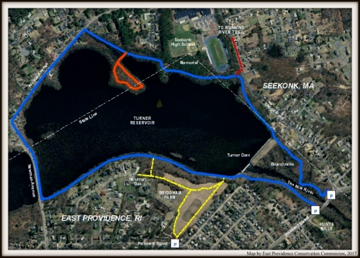
Trail map can be found at: Hunts Mills

Along The Red Trail