Posts Tagged ‘ State Park ’

Spring Lake Trail – Cranston

  • Spring Lake Trail
  • Laten Knight Road, Cranston, RI
  • Trailhead:  41°44’44.41″N, 71°32’25.40″W
  • Last Time Hiked: March 24, 2020
  • Approximate distance hiked: 1.2 miles
  • Fairly easy, significant elevation.


This newly blazed trail is on an old State property. Spring Lake is part of the Curran Reservoir State Park. This State Park, however was never developed. The northern end around Curran Reservoir is open to hunting. Although the southern end is not, it is advised to wear orange during hunting season nevertheless. The trail starts at a small parking area along Laten Knight Road and descends quickly down hill. The trail at first is hard to delineate, but the wide open forest floor leaves plenty of room to get back on track. A black sign is soon visible with a white arrow below a “Spring Lake” sign. For the remainder of this hike you continue forward looking for the next sign as it makes a loop through the southern end of the property. As the trail passes the lake there is a dead end spur trail that leads along and below the dam. The engineering of the dam is quite intriguing and worth checking out if you are so inclined. Following the signs you will complete the loop, the remainder of the hike will test your stamina as you retrace your steps all uphill to the parking area.

TWRI-SLT03

Trail to Spring Lake

Demarest Lloyd State Park – Dartmouth

  • Demarest Lloyd State Park/Wylde Reserve
  • Barneys Joy Road, Dartmouth, MA
  • Trailhead:  41°31’21.26″N, 70°59’18.08″W
  • Last Time Hiked: March 1, 2020
  • Approximate distance hiked: 2.8 miles
  • Fairly easy with a beach walk.

A little research will go a long way. Demarest Lloyd State Park is essentially a beach on the shores of Buzzards Bay with a few trails. There is an entrance fee in the summer months and in the winter months the gates are closed adding a half mile walk down the entrance road. With that being said, at the very end of Barneys Joy Road on the left is the Wylde Reserve, a Dartmouth Natural Resource Trust property. There is just enough room to park one maybe two vehicles at most here. The trail starts at the chained gated. About fifty feet into the property you will find a kiosk. What is nice about this reserve is that its an out and back trail that starts right at the road and leads into the State Park while passing Georges Pond and carpet of thick shrubs. No need to pay an entrance fee or walk along a long paved road. After crossing the boundary between the two properties (which you likely won’t notice) continue straight at all the narrow trail intersections until you reach a wider sandy cart path. Turn left here and follow the path to the parks parking area by the restrooms. Here turn right to reach the beach and then turn to the left (north) and follow the beach to the point. The rocky beach does become sandy near the point. From here retrace your steps back to the entrance of the Wylde Reserve.

Map can be found at: Wylde Reserve.

TWRI-WLD04

Sandy Cart Path and Pitch Pines

Ninigret Beach – Charlestown

  • Ninigret Beach (East Beach)
  • East Beach Road, Charlestown, RI
  • Trailhead:  41°20’37.88″N, 71°41’22.71″W
  • Last Time Hiked: February 15, 2020
  • Approximate distance hiked: 5.8 miles
  • Fairly easy beach walk.


The beach between Blue Shutters Beach and the Charlestown Breachway is part of East Beach State Park and the Ninigret National Wildlife Refuge. It is a long three mile strand of beach that is not overwhelmed with humans. In the summer a fee must be paid the access the beach and parking is very limited. In the winter the beach is desolate, especially at sunrise. This day was a windless but brutally cold February morning. Hike time temperature was a sweltering 7 degrees Fahrenheit. I came here armed with cameras to catch the sunrise, multiple layers of clothes, but mostly to find solitude to clear the mind. Success! I arrived at the small parking area before sunrise and made my way to the beach. To the east I could see the beacon of the Point Judith Light. To the south I could see the lights of Block Island twinkling. Along the horizon between them, the glows of pink, magenta, fuchsia, and orange setting the sky up for a spectacular sunrise. I turned to the east and followed the empty beach for a few miles. At 6:42 AM, just as scheduled, the piercing light of the sun broke the horizon. The beach suddenly a glow of of the colors in the sky. In the distance I could make out my destination, a dark shadow strip of the breachway stretching into the ocean. As the sun rose into the sky the beach came to life with sea birds. The waves broke gently and peacefully.  I spent only a few minutes at the breachway before retracing my steps back to the parking area. This walk is exactly what was needed. I did not run into a single soul! Also as a side-note, I was still cold when I ordered my breakfast sandwich at Sophie’s (in Exeter) a little while later.

TWRI-EastBeach01

Winter Sunrise

Cross Town Trail – Groton

  • Groton Cross Town Trail
  • Depot Road, Groton, CT
  • Trailhead:  41°20’8.29″N, 72° 1’58.54″W
  • Last Time Hiked: November 2, 2019
  • Approximate distance hiked: 6.0 miles
  • Moderate with some hills and rugged areas. Navigation can be difficult in areas.


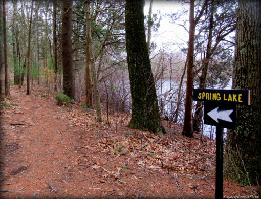
The town of Groton offers a trail that connects several properties while it traverses quite literally cross town. The trail, six miles in total one way, starts at Bluff Point State Park, winds through Haley Farm State Park, meanders through the Mortimer Wright Preserve and Merritt Family Forest before coming to a half mile of road walking, climbs through Beebe Pond Park and Moore Woodlands, and finally to Town’s End Preserve. Starting at the parking area for Bluff Point, the trail starts to the left by the composting toilets. Follow the main path ahead through areas of ledge, pass a gate and you will soon be parallel to the Amtrak tracks. To the right are some spectacular views of the upper reaches of Mumford Cove. The trail then veers slightly to the right and uphill. At the top of the hill turn left at the wooden steps and left again to cross the bridge. After crossing the bridge you have entered Haley Farm State Park. Just ahead is a gate to the right. Take the turn here, pass the gate and follow this trail. Following this trail will lead you to the main parking area for Haley Farm. Along the way you pass several small boulders and old farm stone walls before the trail turns into a stone dust path. A massive, and quite impressive stone wall will be to your left before coming to the open field just before the parking area. The trail continues to the left (north side of the parking area), however, though not technically part of the Cross Town Trail, it is well worth checking out while here. At the composting toilet is an opening at the wall. Follow the trail here and straight at the next intersection. The trail then turns to the left and back southerly. This small additional stretch is grass mowed through a field with an abundance of birds and thickets of berries and sumac. At the next intersection, continue pass the grass mowed trail to the left, pass the wood post with remains of a gate, and turn right following the trail slightly uphill flanked by a stone wall on the right. At the end of the stone wall there is a narrow trail on the right. Take this trail and follow it first through a cedar grove before passing a few stone walls. There is a trail split ahead just as a catch a glimpse of a pond. Stay to the right here and continue to follow the trail over a few boardwalks and pass Gibson Pond before exiting the State Park at Groton Long Point Road. It does not seem that blazes for the Cross Town Trail were allowed on State Property. At the time of this hike orange dots were observed at several points along the way. They were helpful, however it is very advisable to use GPS (particularly through State lands) in the event you may need to backtrack. Good news! The remainder of the trail is blazed blue through all of the remaining properties and there are trail maps at all the major intersections. Just be sure to keep an eye from blaze to blaze to assure you are on the right trail. Continuing ahead across Groton Long Point Road and slightly to the right you will come to the first blue blaze at Mortimer Wright Preserve. The trail winds up and down hill for the next couple miles passing beech groves, several stone walls, “frog crossings”, an esker and moraine, and streams as it passes the Wright Preserve and Merritt Family Forest. This stretch is absolutely beautiful and is well populated by deer, songbirds, and squirrels. The next half mile is road walking, crossing Fishtown Road, turning onto and following to the end of Rhonda Drive, right onto Farmstead Avenue, then right onto Judson Avenue. After Somersett Drive (on the left) start looking for the trailhead at Beebe Pond Park on the right. Follow the blue blazed trail once again through Beebe Pond Park and Moore Woodlands. This stretch can be a little rugged with rocky and root bound trails, so it is advisable to watch your step while walking and stop to take in the scenery. On the way out of the Beebe Pond Park is a massive stone wall to the right. It looks as it might have been part of a mill or dam. The trail then comes out to 850 Noank Road. This is a good spot for a second vehicle if you are going to car spot this hike. The Cross Town Trail then continues by turning left and following Noank Road for a couple hundred feet and the turning right at the gated Town Ends Preserve. The trail then ends about a tenth of mile into the preserve at Beebe Cove.


Map can be found at: Cross Town Trail.

TWRI-XG02

Mumford Cove at Bluff Point.

TWRI-XG17

Autumn at Merritt Family Forest

Massasoit South – Taunton

  • Massasoit State Park South
  • Bearhole Road, Taunton, MA
  • Trailhead:  41°51’56.43″N, 70°59’15.91″W
  • Last Time Hiked: May 21, 2019
  • Approximate distance hiked: 2.6 miles
  • Fairly easy with some slight elevation.


I had come out to Massasoit State Park to start hiking the system of blazed trails. I was prepared to do the blue loop trail at the southern end of the park when I stumbled upon a major obstacle. Sections of the blue loop were closed due to construction. Already committed to a good portion of the loop I backtracked and did the remainder of the open loop before exploring a few of the side trails in the southwestern part of the park. I was informed by a member of the construction crew that the trail would likely be re-opened in a month or so. Nonetheless, the trails that I did explore were rather quiet covered in pine needles and led to several of the parks ponds. The park itself is quite stunning and well maintained and offers a seasonal campground as well. I will be back in the summer to update this blog.


Map can be found at: Massasoit South

TWRI-Massa02

Big Bearhole Pond

Stoddard Hill – Ledyard

  • Stoddard Hill State Park
  • Connecticut Route 12, Ledyard, CT
  • Trailhead:  41°27’34.60″N, 72° 3’50.40″W
  • Last Time Hiked: April 17, 2019
  • Approximate distance hiked: 0.7 miles
  • Fairly easy with some significant elevation.


This small State Park along the Thames River offers a towering ledge of boulders and a historic cemetery. There is a boat ramp here at the cove and small network of trails. The main trail, unblazed, climbs slightly uphill at first then follows the bank that overlooks the river and railroad below. The trail winds to the left of the ledge slowly going uphill and eventually dead ending near private property. Retracing your steps back a bit you find a trail to the left that leads to the cemetery of the Stoddard Family. Graves here date back to the 1800’s and members of the family fought in the Revolutionary War and War of 1812. There is a trail to the south that leads back to the main trail, downhill, and to the parking area


Map can be found at: Stoddard Hill

TWRI-41702Stoddard

Historic Stoddard Family Cemetery with Ledge Behind It.

Bluff Point – Groton

  • Bluff Point State Park And Coastal Reserve
  • Depot Road, Groton, CT
  • Trailhead:  41°20’8.76″N, 72° 2’0.90″W
  • Last Time Hiked: April 14, 2018
  • Approximate distance hiked: 4.6 miles
  • Fairly easy with some elevation.

Bluff Point State Park once made the CNN list of the 50 states natural wonders. Surprisingly enough, even though it has been on the to do list for quite a while, it took me a few years to finally venture down here to check it out. Groton is a long drive to most Rhode Islanders. Pack a lunch, make a daytrip out of it, get out of Rhode Island once in a while! This place is worth the drive. The park offers well defined trails and signage where needed. The trails are used by walkers, hikers, joggers, bicyclists, and horseback riders. Dogs are welcome but must be leashed. Starting just after sunrise from the seemingly large and nearly empty parking lot at the end of Depot Road we started following the wide gravel road trail just beyond the informational signs. The trail soon splits about one tenth of a mile into the park. Stay to the right here and continue along the main trail that follows the Poquonnock River. You then follow this trail for 1.3 miles until you reach Bushy Point Beach ignoring spur trails both narrow and wide. Along the way there are several spots that overlook the river and features in the distance. Across the river is the bustling Groton-New London Airport. There are views of the peninsulas and points that jut out into the river as well as the lighthouses further in the distance. The Avery Point Lighthouse at the University of Connecticut Avery Point campus is visible as well as the haunted New London Ledge Light. The trail also winds gently up and down small hills flanked by towering trees and passes some areas of marsh and wetlands. There are an abundance of birds here as well. Great blue herons, egrets, cormorants, hawks, robins, cardinals, and woodpeckers were all spotted on this hike. When we reached the beach we explored it for a few minutes. The beach itself extends westward for nearly a mile, but we only ventured in the area around the entrance. The beach is closed in areas during nesting season of least terns and piping plovers. Dogs and horses are not allowed on the beach between April and August. Back to the main trail we climbed up the small hill of the bluff. There are several spur trails to the edge of the bluff and the rocky beach below. The rocky shoreline makes for a good photograph and was also being used by a couple fishermen. Looking to the south you can see Fishers Island from here. Back on the main trail, it starts to wind to the east and then to the north passing Sunset Rock on the left before winding to a cellar hole at a trail intersection. The spot is well marked with a sign that explains that this was once the Winthrop Homestead, the former Connecticut Governor. After lingering at the cellar hole for a bit we decided to follow the less traveled trail to Mumford Cove. There is a sign here indicating which trail to follow. This trail winds downhill through an area of scattered boulders, tall trees, and a seasonal brook before coming to the cove. There are a couple spots along the trail to take a peek at the cove and rest your legs if you so choose. Continuing, now heading north, the trail becomes more of a grass road. There is a large wooded hill to the left and areas of thickets and shrubbery to the right. The trail soon ends at a gravel road that runs from Haley Farm to the parking area where this hike started. Turning left here, follow the gravel road to the large parking area where the car is park. The lot was nearly full when finished the hike. Bluff Point is a very popular recreation spot.

Map can be found at: Bluff Point.

TWRI-Bluff09

Boulder at Bluff Point

TWRI-Bluff03

Trail Flanked By Trees

Tablerock Hill – Lincoln

  • Tablerock Hill – Lincoln Woods State Park
  • Stump Hill Road, Lincoln, RI
  • Trailhead: 41°53’42.13″N, 71°25’36.62″W
  • Last Time Hiked: July 23, 2017
  • Approximate distance hiked: 2.5 miles
  • Moderate due to terrain, navigation can be difficult.


A few quick notes about this hike. Lincoln Woods is notorious for having many unmarked trails that one could easily get lost on. It is highly recommendable that you use a GPS device if you choose to embark on this hike. Although I tried to keep it as easy as possible (as far as navigation) I think improvements can be made. Some of this hike is road walking and I do believe there are other trails that can eliminate that. I fully intend on returning to this area of Lincoln Woods to explore further and finalize a route.


This hike starts at the dam at the eastern end of Olney Pond in Lincoln Woods. There is a parking area suitable for about 15 cars. At the north end of the parking lot is the Jodi Lussier Memorial. Pass the rock and veer left to the right of large outcrop onto a trail that leads into a small valley.  Stay to the left and follow the wider trail that approaches the pond. To the right just before the pond is a trail to the right that climbs uphill. At the top of the hill you will encounter your first experience of multiple trails to choose from. For this hike, stay to the left to parallel the pond. The trail soon dips close to the shore and is marked with red squares. The trail winds, with the pond to left and a hill with boulders on right, up and over small hills following the red square blazes. Along the way there are several spots to view pond. Ahead the trail splits. The trail to the right comes out to an old woods road that you will be on later. For now stay close to the pond. The key is to continue ahead taking lefts to continue to parallel the pond. By doing so you will turn onto a peninsula onto a trail that leads out to Sunset Point. The trail turns to the right, still following the shore, around the point and up to a rock outcrop that overlooks the pond. From here continue to follow the trails along the ponds edge and it will come back to the old woods road. Turn left here and follow the road downhill, again continuing to follow the shore. The aptly named Boulderwood Cove is now on your left. To be sure you are where you should be, you should see a single boulder emerging from the water at this point. Ahead is another multiple trail intersection. Turn left and the trail almost immediately splits. Stay to the left again following the path by the shore once again. Another split is ahead, again stay to the left. Continuing straight ahead there are a couple spur trails to the right you will ignore. Soon you will pass a large balancing boulder on the right. Continue straight ahead following the most defined trail until you reach a flat area surrounding you with large rocks. Here the trail splits again. This time stay slightly to the right (straight) and up the small hill. This trail and another merge at the top of the hill. Stay to left towards the massive boulders. Continuing ahead the trail you are on merges with another. Continue ahead to road passing through picnic site 59. Across the road is picnic site 27. To the left of the site is the trail that scrambles uphill. Cross the road and follow this trail uphill to another massive ledge. Stay to the left of the large rock and follow the base of it to the other side. Continuing the trail narrows and continues straight ahead following faded green dots. Soon the trail abruptly turns left down a rock outcrop into a small valley and crosses a stream. The trail narrows even further, then takes sharp right at a large boulder. Follow the face of the boulder, the trail turns slightly left and then continues straight to Quinsicket Road. Turn right follow road passing picnic sites 29 through 32 on the right. On the left you will notice signs indicating that the trails are used by horse back riders. Follow the paved road up and over a significant hill. As the road starts to climb up again it bends to the left. There is a parking area on the right. Turn right here through the parking area toward row of concrete blocks and rocks that block the old woods road. Grass covered at first, and blazed blue, this trail heads east. To the right is the top of Tablerock Hill. The trail then starts to descend and becomes quite rocky. At the next split the blue blazes stay to left. Here you want to stay to the right and go downhill. The next intersection, at the bottom of the hill, turn right and follow dirt road that leads to picnic sites 2 and 3. Continuing pass the picnic sites you will soon turn right onto the road that wraps around a large field on the left. On the right is the entrance of picnic site 4. At the back of the site is a large ledge with an inscription in it about Bobby Donato, a local, who served in the United States Marines. Retracing you steps back to the road. Continue to the entrance of picnic site 5. Here at the sites entrance is a large outcrop known as Pulpit Rock. It is said that Metacom, a Wampanoag leader, would address his warriors here. Just beyond the picnic site are two trails. For this hike take the one to the left. It passes a small quarry on the left and a small pond on the right before it starts climbing uphill with a stone wall on the left. The trails soon come together, stay to the left here on the more defined trail. This trail continues to climb uphill and soon bends to the right. Ignore the trail to the left and continue another 30 feet or so to the next trail intersection. It is here you will turn left and follow the trail passing a boulder on your right. Continue straight, staying to the left trail downhill as it traverses over an outcrop and then soon a wooden bridge over a stream. To your left are picnic sites 10 and 11 and Goat Rock. For this hike continue straight. The trail here is a wide dirt path that also passes picnic sites 13 and 14 again on your left. Continue straight to the next intersection then veer to left. This trail leads you to the backside of some more picnic sites. Stay on the trail as it bends to the right up and over one last hill. At the top of the hill you will see the road ahead. This trail ends at the road intersection, cross the road and continue straight. You are now on Stump Hill Road and your car is ahead on the right.


Trail map can be found at: Tablerock Hill.

TWRI-TRH02

Boulderwood Cove

TWRI-Donato

Inscription In Donato Rock at Lincoln Woods.

Barney Pond – Lincoln

  • Barney Pond
  • Table Rock Road, Lincoln, RI
  • Trailhead: 41°54’8.96″N, 71°25’34.68″W
  • Last Time Hiked: July 1, 2017
  • Approximate distance hiked: 1.6 miles
  • Moderate to difficult due to navigation, otherwise fairly easy.


Lincoln Woods State Park is a sprawling property with miles and miles of unmarked trails. Most people that come here to walk do the loop trail around Olney Pond. But for the more adventurous there are places to see that most wouldn’t. Barney Pond, to most, is accessible along Smithfield Avenue in Lincoln. There is a small bridge and parking area here by the dam that creates the pond. On the opposite side is a series of trails that most people are not aware of. For this hike we explored that lesser known shore and other highlights of Lincoln Woods. Starting from a parking area at the baseball fields, we made our way down the road back towards the entrance and slightly downhill turning right into picnic site 5. Here at the sites entrance is a large outcrop known as Pulpit Rock. It is said that Metacom, a Wampanoag leader, would address his warriors here. Just beyond the picnic site are two trails. For this hike take the one to the left. It passes a small quarry on the left and a small pond on the right before it starts climbing uphill with a stone wall on the left. The trails soon come together, stay to the left here on the more defined trail. This trail continues to climb uphill and soon bends to the right. Ignore the trail to the left and continue another 30 feet or so to the next trail intersection. It is here you will turn left and follow the trail passing a boulder on your right. Continue straight, staying to the left trail downhill as it traverses over an outcrop and then soon a wooden bridge over a stream. After the bridge, turn left at the row of wood bollards into picnic sites 10 and 11. To the left is a massive outcrop known as Goat Rock, apparently named so because a goat once got stuck in one of its crevices. From here follow the road and stay to the left passing site 9 on the left and a large cluster of boulders on the right. Soon you will pass a gate and a wood guard rail to the right. Cross over Table Rock Road towards a large outcrop. Stay to the right of it and follow the road to picnic site 66 -80. After the road bends to the right start looking for picnic site 79 which is setback off the road. Cross through the picnic site to a trail at the back end of it. From this point forward navigation becomes difficult in areas. If you are not overly adventurous and/or do not have a good sense of direction you may reconsider this portion of the hike. GPS is also highly recommendable from this point forward. From the back of the picnic site follow the less define leaf covered trail slightly downhill away from the site. After a short distance turn left onto a trail that has been partially washed out. This trail looks like an old cartpath from yesteryear. It is obvious that people still use the trail but it is also obvious that it is not many people. The trail at times become very narrow, almost to the point of non-existence. Along this stretch we encountered deer. After going downhill for a bit the trail finally widens as you catch a glimpse of Threadmill Brook down in a valley to the right. Continuing straight and downhill, you will soon pass a trail on the left. Keep going straight passing a formation of stones in the trail that are obviously manmade. Ahead you will catch your first glimpse of Barney Pond. The main trail bends to the right here following the shore to a small bridge that crosses Threadmill Brook. Beyond the bridge is private property. For this hike, as the trail approaches the pond you want to turn to the left following the shore. You will soon find a narrow trail that parallels the west shore of the pond. The trail heads in a generally northerly direction and can be quite overgrown in areas, but it offers a few areas that overlook the pond. We were greeted by ducks and swans at one of these spots. Barney Pond is a manmade pond created when the Moshassuck River was dammed at Smithfield Avenue. The pond is about 25 acres and used primarily for fishing and kayaking. After passing a makeshift log “road” and a stone wall the trail widens as it enters a canopy of the woods. There is a homemade dock at a peninsula. From here the trail continues north into an area of Japanese Knotweed. In the height of summer the trail can vanish, quite literally. If the trail has been used recently you should be able to make your way through the broken knotweed. If not, your other choices are to retrace your steps or follow a faint trail from the homemade dock in a westerly/southwesterly direction up the hill where you should find a cartpath. That cartpath will lead you back to the trail that runs along Threadmill Brook. Either way, be sure to use GPS. For this hike, continue following the trail through the knotweed. It soon comes to the northern reaches of the pond, now slightly off into the distance to the right. This trail soon comes to Table Rock Road. If you have come this far, congratulations, well done! Turn right and follow the road to the shack. Here you will see the iconic Lincoln Woods covered bridge. Turn left onto the road to the baseball fields. Soon you will come to where your vehicle is parked. Again, this hike is only suggested for those who are comfortable being in the woods, adventurous and/or have a good sense of direction.


Trail Map can be found at: Barney Pond

TWRI-Barney

Swans on Barney Pond

Goddard State Park – Warwick

  • Goddard Memorial State Park
  • Ives Road, Warwick, RI
  • Trailhead: 41°39’12.72″N, 71°26’36.43″W
  • Last Time Hiked: September 19, 2014
  • Approximate distance hiked: 4.6 miles
  • Fairly easy with slight elevation.


Almost directly across Narragansett Bay from the East Bay crown jewel, that being Colt State Park, is the West Bay equivalent. Goddard State Park offers a little bit of everything. It has a plethora of picnic areas, fields, a former carousel now used for events, a public beach, and of course trails. The trails that traverse the park are in fact bridle trails used by C and L Stables and you are likely to encounter a passing horse on occasion. They offer horseback riding to the public.  I obtained a copy of the park map and somewhat mimicked in reverse the route in Ken Weber’s “More Walks & Rambles” book. I started today’s hike from the parking area at the boat launch. A trail leads uphill from the parking area in a northeasterly direction. The trails here are wide and relatively soft, covered in most spots with either mulch, sand, and pine needles. You should keep an eye on where you are stepping. After all these are active bridle trails (if you know what I mean). After following this trail for a little while it splits. I stayed to the right and the trail then turns slightly left and rejoins itself. Here I turned right. A trail then veers off to the left, I continued straight and followed the trail through tall pines and various other trees. The trail then starts to turn to the right and joins another trail. Almost immediately a trail appears on the left, I choose to continue straight passing an area that appeared to be used for composting. A trail then appeared on the left. I turned here. This trail meandered in and out of the woods and along the edges of the fields before finally turning back into the woods. At the next intersection I turned right, crossed the road, and came to the park headquarters building. I stopped here to inquire about some of the parks features. The staff was very friendly and extremely helpful. I then continued along the trail in an easterly direction ignoring the three trails that were to the left. I also noticed a stone wall to the right along this stretch which seemed to be a haven for chipmunks. There was also an abundance of birds along this stretch. I then soon found myself along the edge of a residential neighborhood. This is private property. Please stay on the trail and respect the posted signage. After passing yet another trail on the left I came to an intersection. I turned right onto a loop trail. About midway through the loop a trail appears on the right. It is not shown on the map. It leads down to Sally Rock Point. From here you can see the Buttonwoods neighborhood across Greenwich Way as well as Oakland Beach, a tall stone tower on Warwick Neck, Patience Island, and Prudence Island. A few iconic Rhode Island sailboats were passing through the waters. There were also many sea gulls and a cormorant here. After taking a short and scenic break I retraced my steps back to the loop trail. I then turned right and then right again following the trail that hugged the bank above the shore. I stayed to the right at all of the intersections along this stretch. Soon I found myself passing a small pond on the left. Here there were several swans and geese wading around. Continuing along the trail along the bank above the Bay I eventually came to a parking area for the public beach. I passed through the parking lot making my way to the carousel. Originally built in New York in 1890 by Charles Loof, the carousel had several homes before finally coming to Goddard. From 1931 until 1973 the carousel was in operation here. All that remains today is the building. The structure is now used for private parties and events. From the carousel I passed a time capsule commemorating the 100th anniversary of the park before crossing the bridge over the road. Then I turned right slightly passing through a picnic area before coming to the trail once again. This trail again follows the bank over the bay before bending back toward the left. I then came to an intersection. I followed the trail to the right down to the beach by Long Point. From here (it was low tide) I followed the beach along Greenwich Cove back to the parking area by the boat launch. I came across a gentleman here who asked if I got a picture of an eagle that was in the area. Busy taking pictures of the boats in the cove, I did not see the eagle. He did however show me a video he took of it with his phone. I really wish I had seen it. With all that it has to offer, it is no wonder why this park won Rhode Island Monthly’s Best Free Attraction for multiple years. The walk I took was about 4 and a half miles. According to the parks website, there are 18 miles of bridle trails here. You could easily make this walk longer if you choose.

Trail map can be found at: Goddard State Park.

Along A Bridle Trail

Along A Bridle Trail

Greenwich Cove At Goddard Park

Greenwich Cove At Goddard Park